By car (off-peak)


Sold
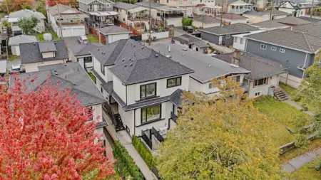
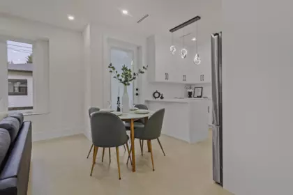
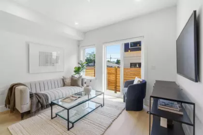
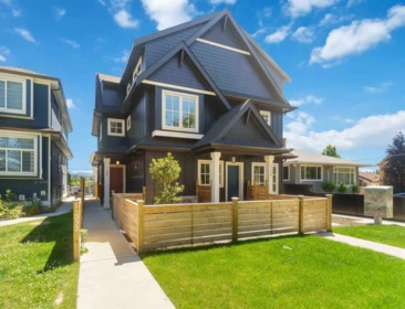
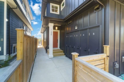
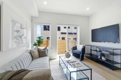
4911 Frances Street, Burnaby, BC
5
Beds
4
Baths
2130
sqft
2024
built

1 3391 Victoria Drive, Vancouver, British Columbia V5N 4M3

Public Schools
Information includes BC Government Open License data; school details change often and are offered solely as general guidance.
Private Schools
Closest Transit
Crime Rate
Demographics
Noise/ Power Lines
Other
1 3391 Victoria Drive has a sell-speed score of 50/100, placing it in the "Expected to sell at a moderate pace" band. The listing is has limited comparable pricing data available. Based on these signals, EstateBlock predicts this listing is may take several weeks to attract serious offers.
Natural hazards vary by location and can change over time. The following provides a summary of potential impacts to this area, postal code V5N 4M3, over the next 30 years. Projections use the 2041–2070 period (2050s) under a moderate emissions scenario (SSP2-4.5).
Outside of designated flood hazard zones. Under 10% of buildings in this area have flood risk over the next 30 years.
Located within the "Vancouver" WUI zone (Risk Class 5 — Low). Based on BC Wildfire Service provincial WUI Risk Class mapping; not a site-specific assessment.
Annual avg PM2.5 5.1 µg/m³ — meets Canada's CAAQS. Nearest station: Vancouver Clark Drive, Vancouver (~1 km). Annual avg AQHI 2.2 — Low Risk.
Vancouver currently sees ~1 day above 30 °C per year (1981–2010 baseline), projected to rise to ~6 by the 2050s (SSP2-4.5 moderate emissions). Hottest day of the year: ~29.7 °C baseline, ~32 °C projected. Tropical nights (>18 °C): ~0 baseline, ~4 projected.
Annual precipitation ~1515 mm (1981–2010 baseline), projected ~1575 mm by the 2050s. Extreme 1-day rainfall: ~50.5 mm baseline, ~57 mm projected. Values vary modestly across the Lower Mainland.
Longest annual dry spell (consecutive dry days): ~22 days baseline, ~24 days projected for the 2050s. CDD is used as a regional drought proxy; drought risk varies modestly across the Lower Mainland.


53 Schools are within 3km
| School | Type | Grades Served | Catchment Info | Rating | Distance |
|---|---|---|---|---|---|
Stratford Hall |
Independent |
Grades Served—
|
Catchment Info—
|
Distance330 m
|
|
Stratford Hall School |
Independent |
Grades ServedK-12
|
Catchment Info—
|
Distance367 m
|
|
St.Joseph's School |
Independent |
Grades ServedK-7
|
Catchment Info—
|
Distance391 m
|
|
Tyee Elementary School |
Public |
Grades ServedK-7
|
Catchment Info—
|
Distance560 m
|
|
Lord Selkirk Elementary School |
Public |
Grades ServedK-7
|
Catchment Info—
|
Distance585 m
|
|
Gladstone Secondary School |
Public |
Grades Served8-12
|
Catchment InfoIn Catchment
|
Distance771 m
|
|
Gladstone Secondary |
Public |
Grades Served—
|
Catchment Info—
|
Distance791 m
|
|
Laura Secord Elementary School |
Public |
Grades ServedK-7
|
Catchment Info—
|
Distance854 m
|
|
Lord Beaconsfield Elementary School |
Public |
Grades ServedK-7
|
Catchment InfoIn Catchment
|
Distance1.05 KM
|
|
Lord Selkirk Annex |
Public |
Grades ServedK-4
|
Catchment Info—
|
Distance1.15 KM
|
|
Charles Dickens Elementary School |
Public |
Grades ServedK-7
|
Catchment Info—
|
Distance1.19 KM
|
|
Westside Montessori Academy |
Independent |
Grades ServedK-7
|
Catchment Info—
|
Distance1.19 KM
|
|
Vancouver Technical Secondary |
Public |
Grades Served—
|
Catchment Info—
|
Distance1.26 KM
|
|
Charles Dickens Annex |
Public |
Grades ServedK-3
|
Catchment Info—
|
Distance1.29 KM
|
|
Queen Victoria Annex |
Public |
Grades ServedK-5
|
Catchment Info—
|
Distance1.41 KM
|
|
Sir Richard McBride Elementary School |
Public |
Grades ServedK-7
|
Catchment Info—
|
Distance1.51 KM
|
|
St.Jude's School |
Independent |
Grades ServedK-7
|
Catchment Info—
|
Distance1.75 KM
|
|
Coquitlam College - Brookmere Secondary |
Independent |
Grades Served—
|
Catchment Info—
|
Distance1.77 KM
|
|
John Norquay Elementary School |
Public |
Grades ServedK-7
|
Catchment Info—
|
Distance1.77 KM
|
|
Nootka Community Elementary School |
Public |
Grades ServedK-7
|
Catchment Info—
|
Distance1.78 KM
|
|
Chief Maquinna Elementary School |
Public |
Grades ServedK-7
|
Catchment Info—
|
Distance1.87 KM
|
|
Sir Richard McBride Annex |
Public |
Grades ServedK-3
|
Catchment Info—
|
Distance1.97 KM
|
|
Norval-Morrisseau |
Public |
Grades Served—
|
Catchment Info—
|
Distance2.00 KM
|
|
Tecumseh Annex |
Public |
Grades ServedK-3
|
Catchment Info—
|
Distance2.02 KM
|
|
Lord Nelson Elementary School |
Public |
Grades ServedK-7
|
Catchment Info—
|
Distance2.04 KM
|
|
Lord Nelson Elementary |
Public |
Grades Served—
|
Catchment Info—
|
Distance2.05 KM
|
|
G. T. Cunningham Elementary School |
Public |
Grades ServedK-7
|
Catchment Info—
|
Distance2.11 KM
|
|
Florence Nightingale Elementary School |
Public |
Grades ServedK-7
|
Catchment Info—
|
Distance2.11 KM
|
|
Britannia Community Elementary School |
Public |
Grades ServedK-7
|
Catchment Info—
|
Distance2.23 KM
|
|
Windermere Community Secondary School |
Public |
Grades Served8-12
|
Catchment Info—
|
Distance2.24 KM
|
|
Mount Pleasant Elementary School |
Public |
Grades ServedK-7
|
Catchment Info—
|
Distance2.27 KM
|
|
David Livingstone Elementary School |
Public |
Grades ServedK-7
|
Catchment Info—
|
Distance2.33 KM
|
|
Britannia Community Secondary School |
Public |
Grades Served8-12
|
Catchment Info—
|
Distance2.38 KM
|
|
St. Francis Xavier |
Independent |
Grades ServedK-7
|
Catchment Info—
|
Distance2.45 KM
|
|
St Francis Xavier |
Independent |
Grades Served—
|
Catchment Info—
|
Distance2.46 KM
|
|
St Francis of Assisi |
Independent |
Grades ServedK-7
|
Catchment Info—
|
Distance2.46 KM
|
|
Renfrew Community Elementary School |
Public |
Grades ServedK-7
|
Catchment Info—
|
Distance2.48 KM
|
|
Tecumseh Elementary School |
Public |
Grades ServedK-7
|
Catchment Info—
|
Distance2.59 KM
|
|
St Patrick's |
Independent |
Grades Served—
|
Catchment Info—
|
Distance2.60 KM
|
|
Sir Alexander Mackenzie Elementary School |
Public |
Grades ServedK-7
|
Catchment Info—
|
Distance2.64 KM
|
|
Sir Wilfred Grenfell Community School |
Public |
Grades ServedK-7
|
Catchment Info—
|
Distance2.66 KM
|
|
Sir Wilfred Grenfell Community |
Public |
Grades Served—
|
Catchment Info—
|
Distance2.66 KM
|
|
St.Patrick's Elementary School |
Independent |
Grades ServedK-7
|
Catchment Info—
|
Distance2.69 KM
|
|
Templeton Secondary School |
Public |
Grades Served8-12
|
Catchment Info—
|
Distance2.70 KM
|
|
St.Patrick Regional Secondary School |
Independent |
Grades Served8-12
|
Catchment Info—
|
Distance2.71 KM
|
|
Vancouver Christian |
Independent |
Grades Served—
|
Catchment Info—
|
Distance2.75 KM
|
|
Vancouver Christian School |
Independent |
Grades ServedK-6
|
Catchment Info—
|
Distance2.76 KM
|
|
Columbia College |
Independent |
Grades Served11-12
|
Catchment Info—
|
Distance2.79 KM
|
|
Admiral Seymour Elementary School |
Public |
Grades ServedK-7
|
Catchment Info—
|
Distance2.84 KM
|
|
Notre Dame Regional Secondary School |
Independent |
Grades Served8-12
|
Catchment Info—
|
Distance2.86 KM
|
|
General Brock Elementary School |
Public |
Grades ServedK-7
|
Catchment Info—
|
Distance2.86 KM
|
|
General Wolfe Elementary School |
Public |
Grades ServedK-7
|
Catchment Info—
|
Distance2.95 KM
|
|
Our Lady of Sorrows School |
Independent |
Grades ServedK-7
|
Catchment Info—
|
Distance2.99 KM
|
Calculate your commute
1 3391 Victoria Dr, Vancouver, BC is ideally located for commuters. The property is 0.9 km from Commercial-Broadway, with a 22 min SkyTrain ride to Downtown Vancouver (Waterfront Station). The closest bus stop is Southbound Victoria Diversion @ Commercial St (0.12 km). Walk Score Transit rating: Excellent Transit (77/100).


Buy Vs Rent Calculator
Rent vs own
—

Potential Cashback for this listing if you buy with us
to track your cashback progress
Buy with us & save on this property

$1,599,000
4015 Victoria Drive, Vancouver, BC
$1,699,000
4015 Victoria Drive, Vancouver, BC 7.7% price reduction
$1,549,000
4136 Beatrice Street, Vancouver, BC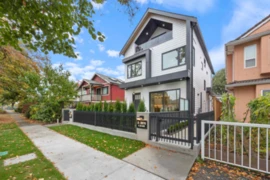
$1,620,000
2 2070 E 26th Avenue, Vancouver, BC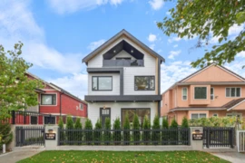
$1,588,888
1 2070 E 26th Avenue, Vancouver, BC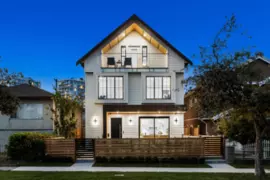
$1,438,000
1 2211 Mannering Avenue, Vancouver, BC
$1,438,000
1 2211 Mannering Avenue, Vancouver, BC
$1,450,000
1907 E 40th Avenue, Vancouver, BC