
2099 Lougheed Hwy, Agassiz BC – Land for Sale – MLS® R2982601
2099 Lougheed Highway, Agassiz, British Columbia V0M 1A1
Photos


Property Details for 2099 Lougheed Highway
This stunning and private 4.55-acre property offers gently sloping terrain with a perfect plateau at the back—an ideal spot to build your dream home. A drilled well is already in place, and a gated driveway leads to the rear of the property, providing both privacy and convenience. Plenty of space to add a shop or additional structures. Experience year-round peace and tranquility in a prime location near Sandpiper Golf Course, Hemlock Valley, Fraser River fishing, paragliding, quading, hiking, and more! Please do not walk through the property without an appointment
Exterior Features
| Structures | Land Only |
|---|
Building Details
| Price | $750,000 |
|---|---|
| Property Type | Land |
| Ownership Type | Freehold NonStrata |
| Utility Type | Sanitary Sewer Septic Tank, Storm Sewer Not Available, Electricity Available, Natural Gas Not Available, Phone Nearby, Cable Available |
| Water (WaterSource) | Well Drilled |
Lot & Land
| Lot Size | 4.55 |
|---|---|
| Lot Size Depth | Feet |
| MLS® # | R2982601 |
| Area | Agassiz |
| Neighbourhood | Mt Woodside |
| City | Agassiz |
| Postal Code | V0M 1A1 |
| Gross Taxes | $2,858.33 |
| Zoning | RR1 |
Property Timeline
Listed by: Sutton Group - 1st West Realty
NOTE: This representation is based in whole or in part on data generated by the Chilliwack & District Real Estate Board, Fraser Valley Real Estate Board or Greater Vancouver REALTORS® which assumes no responsibility for its accuracy.
Map & Neighbourhood
Private Schools
- Elementary, Secondary
- Mount Cheam Christian School
- 6.93 km
- Elementary, Secondary
- Mount Cheam Christian School
- 6.93 km
Closest Transit
- Bus Stop
- Strathcona at Kent (WB)
- 5.87 km
- Skytrain
- West Coast Express @ Mission City Station
- 31.17 km
Crime Rate
- Total Crime Rate
- Average
- Violent Crime Rate
- Above Average
- Property Crime Rate
- Below Average
Demographics
- Post-Secondary Education
- Below Average 8.7%
- No Certificate/Degree
- Above Average 23.7%
- Owner Occupied
- Below Average 54.5%
- Employment Rate
- Below Average 46%
Noise/ Power Lines
- Road/Hwy Noise
- Possible
- Railway/Sky train Noise
- Unlikely
- Airport/Port Noise
- Unlikely
- Close to major Power Lines
- Unlikely
Other
- Agricultural Land Reserve (ALR)
- Unlikely
- Flood Area
- Unlikely
- Close to Cemeteries
- Unlikely
Sell Speed & Competition
2099 Lougheed Highway has a sell-speed score of 24/100, placing it in the "May take longer than the area average to sell" band. The listing is priced 71.8% above comparable active properties in Mt Woodside. The local market is currently a Buyer's Market with a sales-to-active ratio of 10.8% and an area average of 35 days on market — buyers have more leverage. With only 809 competing homes currently listed, this property has significant competition. Based on these signals, EstateBlock predicts this listing is could take longer than the area average to sell.
Climate Risk for V0M 1A1
Natural hazards vary by location and can change over time. The following provides a summary of potential impacts to this area, postal code V0M 1A1, over the next 30 years. Projections use the 2041–2070 period (2050s) under a moderate emissions scenario (SSP2-4.5).
Outside of designated flood hazard zones. Under 10% of buildings in this area have flood risk over the next 30 years.
Located within the "Chilliwack" WUI zone (Risk Class 3 — Moderate). Based on BC Wildfire Service provincial WUI Risk Class mapping; not a site-specific assessment.
Annual avg PM2.5 4.6 µg/m³ — meets WHO 2021 guideline. Nearest station: Chilliwack Airport, Chilliwack (~9.2 km). Annual avg AQHI 1.8 — Low Risk.
Kent currently sees ~4 days above 30 °C per year (1981–2010 baseline), projected to rise to ~16 by the 2050s (SSP2-4.5 moderate emissions). Hottest day of the year: ~31.5 °C baseline, ~34.1 °C projected. Tropical nights (>18 °C): ~0 baseline, ~3 projected.
Annual precipitation ~1591 mm (1981–2010 baseline), projected ~1630 mm by the 2050s. Extreme 1-day rainfall: ~57.9 mm baseline, ~62.5 mm projected. Values vary modestly across the Lower Mainland.
Longest annual dry spell (consecutive dry days): ~21 days baseline, ~23 days projected for the 2050s. CDD is used as a regional drought proxy; drought risk varies modestly across the Lower Mainland.
Nearby Restaurants, Cafes & Shops

Cafes (1 nearby)
- Motel cafe · 382 m · Cafe
Walkability & Transit Near 2099 Lougheed Highway

Walk Score - Car-Dependent

Transit Score - Minimal Transit

Bikeable 21
Bike Score - Somewhat Bikeable
Mortgage Calculator for 2099 Lougheed Highway
Investment Cashflow Calculator
Estateblock Rent Estimate for 2099 Lougheed Highway, Agassiz
Buy Vs Rent Calculator
Rent vs own
—
Price vs Neighbourhood Average — Mt Woodside, Agassiz
Based on 2 comparable active properties in Mt Woodside, the average asking price is $436,633. This listing is priced 71.8% above the neighbourhood average.
Call or Text Now!

Earn Cashback on Your Purchase
Potential Cashback for this listing if you buy with us
to track your cashback progress
Buy with us & save on this property
Similar Land for Sale in Agassiz
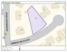
$649,900
10035 Timberline Place, Chilliwack, BC
$819,000
44175 Bayview Road, Mission, BC 6.7% price reduction
$699,950
46142 Cleveland Avenue, Chilliwack, BC 6.7% price reduction
$699,950
46130 Cleveland Avenue, Chilliwack, BC
$699,900
9487 College Street, Chilliwack, BC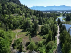
$699,000
44087 Malcolm Road, Mission, BC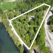
$699,000
44115 Malcolm Road, Mission, BC
$599,900
46280 Second Avenue, Chilliwack, BC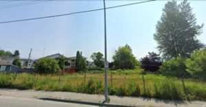 10.0% price reduction
$899,000
9388 Ashwell Road, Chilliwack, BC 34.3% price reduction
$649,900
LT.4 Ohman Road, Mission, BC
$595,000
861 Myng Crescent, Harrison Hot Springs, BC
$560,000
336 720 Hot Springs Road, Harrison Hot Springs, BC600-777 Hornby Street, Vancouver, BC V6Z 1S4. Call 778-918-5990.
