
$3,999,999
7041 193 St, Surrey BC – Land for Sale – MLS® R3106613
7041 193 Street, Surrey, British Columbia V4N 1N2
204 days on the market
$3,070,000
Est. Mortgage $13,582/mo
Listing updated:
EstateBlock checked:
0
sqft
23.2% price reduction
Photos

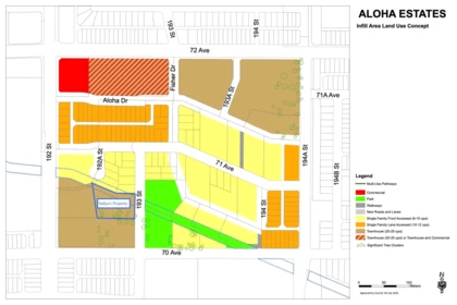
Property Details for 7041 193 Street
23.2% price reduction
Claire Group is pleased to present a compelling redevelopment opportunity for investors: A 1.10-acre RA-zoned parcel in Surrey. The property has a redevelopment application currently at the initial review stage, proposing an 18-unit townhouse project. Prospective buyers are encouraged to consult with the City of Surrey for further details and due diligence inquiries.
Exterior Features
| Structures | Land Only |
|---|
Building Details
| Price | $3,070,000 |
|---|---|
| Property Type | Land |
| Ownership Type | Freehold NonStrata |
| Utility Type | Sanitary Sewer Available, Storm Sewer Available, Electricity Available, Natural Gas At Lot Line, Phone Nearby, Cable Available |
| Water (WaterSource) | Public |
Lot & Land
| Lot Size | 1.1 |
|---|---|
| Lot Size Depth | Feet |
| MLS® # | R3106613 |
| Area | Cloverdale |
| Neighbourhood | Clayton |
| City | Surrey |
| Postal Code | V4N 1N2 |
| Gross Taxes | $27,585.55 |
| Zoning | RA |
Property Timeline
Listed by: RE/MAX Real Estate Services
NOTE: This representation is based in whole or in part on data generated by the Chilliwack & District Real Estate Board, Fraser Valley Real Estate Board or Greater Vancouver REALTORS® which assumes no responsibility for its accuracy.
Map & Neighbourhood
Private Schools
- Elementary,Secondary
- Crescent Heights Academy
- Above Average 1.34 km
- Elementary,Secondary
- Crescent Heights Academy
- Above Average 1.34 km
Closest Transit
- Bus Stop
- Northbound 192 St @ 70 Ave
- 0.16 km
- Skytrain
- Skytrain @ Clayton Station ( Under Construction till 2029)
- 1.21 km
Crime Rate
- Total Crime Rate
- Average
- Violent Crime Rate
- Below Average
- Property Crime Rate
- Average
Demographics
- Post-Secondary Education
- Below Average 20.1%
- No Certificate/Degree
- Below Average 10.6%
- Owner Occupied
- Above Average 88.4%
- Employment Rate
- Average 65%
Noise/ Power Lines
- Road/Hwy Noise
- Possible
- Railway/Sky train Noise
- Unlikely
- Airport/Port Noise
- Unlikely
- Close to major Power Lines
- Unlikely
Other
- Agricultural Land Reserve (ALR)
- Unlikely
- Flood Area
- Unlikely
- Close to Cemeteries
- Unlikely
Sell Speed & Competition
60 / 100
Overall sell-speed score
Moderate pace expected
B+
Price competition grade
Avg comparable: $3,364,720
—
Market conditions
Market conditions unavailable
Flood Risk
Unlikely — not in floodplain
Railway / Skytrain noise
Unlikely — 1.21 km from station
Road / Highway noise
Possible — major road nearby
Airport noise (YVR)
Unlikely
Power lines proximity
Unlikely
ALR (Agricultural Land Reserve)
No — not in ALR
How CLAYTON compares
This property
204 DOM
Clayton avg
—
Surrey avg
—
7041 193 Street has a sell-speed score of 60/100, placing it in the "Expected to sell at a moderate pace" band. The listing is priced 9.6% below comparable active properties in Clayton, which is a strong competitive signal. Based on these signals, EstateBlock predicts this listing is may take several weeks to attract serious offers.
Climate Risk for V4N 1N2
Natural hazards vary by location and can change over time. The following provides a summary of potential impacts to this area, postal code V4N 1N2, over the next 30 years. Projections use the 2041–2070 period (2050s) under a moderate emissions scenario (SSP2-4.5).
Flood
Outside of designated flood hazard zones. Under 10% of buildings in this area have flood risk over the next 30 years.
Fire
Located within the "Vancouver" WUI zone (Risk Class 5 — Low). Based on BC Wildfire Service provincial WUI Risk Class mapping; not a site-specific assessment.
Air Quality
Annual avg PM2.5 4.6 µg/m³ — meets WHO 2021 guideline. Nearest station: Surrey East, Surrey (~0.6 km). Annual avg AQHI 1.8 — Low Risk.
Heat
Surrey currently sees ~1 day above 30 °C per year (1981–2010 baseline), projected to rise to ~8 by the 2050s (SSP2-4.5 moderate emissions). Hottest day of the year: ~30 °C baseline, ~32.5 °C projected. Tropical nights (>18 °C): ~0 baseline, ~3 projected.
Precipitation
Annual precipitation ~1516 mm (1981–2010 baseline), projected ~1574 mm by the 2050s. Extreme 1-day rainfall: ~51.5 mm baseline, ~57.1 mm projected. Values vary modestly across the Lower Mainland.
Drought
Longest annual dry spell (consecutive dry days): ~23 days baseline, ~24 days projected for the 2050s. CDD is used as a regional drought proxy; drought risk varies modestly across the Lower Mainland.
Nearby Restaurants, Cafes & Shops

Restaurants (2 nearby)
- Diamonds sweets · 380 m · Restaurant
- D-plus pizza · 403 m · Fast Food

Groceries (1 nearby)
- Fruiticana · 362 m · Supermarket

Transit (1 nearby)
- Bus stop southbound 188 st @ 70 ave · 968 m · Transit
Schools NearBy
17 Schools are within 3km
| School | Type | Grades Served | Catchment Info | Rating | Distance |
|---|---|---|---|---|---|
Katzie Elementary School |
Public |
Grades ServedK-7
|
Catchment Info—
|
Distance392 m
|
|
Clayton Heights Secondary |
Public |
Grades Served—
|
Catchment Info—
|
Distance1.08 KM
|
|
Crescent Heights Academy |
Independent |
Grades Served—
|
Catchment Info—
|
Distance1.34 KM
|
|
Langley Meadows Elementary |
Public |
Grades Served—
|
Catchment Info—
|
Distance1.61 KM
|
|
Hillcrest Elementary School |
Public |
Grades ServedK-7
|
Catchment Info—
|
Distance1.66 KM
|
|
R C Garnett Demonstration Elementary School |
Public |
Grades ServedK-5
|
Catchment Info—
|
Distance1.81 KM
|
|
Clayton Elementary School |
Public |
Grades ServedK-7
|
Catchment Info—
|
Distance2.01 KM
|
|
Latimer Road Elementary School |
Public |
Grades ServedK-7
|
Catchment Info—
|
Distance2.16 KM
|
|
Adams Road Elementary School |
Public |
Grades ServedK-7
|
Catchment Info—
|
Distance2.17 KM
|
|
R E Mountain Secondary |
Public |
Grades Served—
|
Catchment Info—
|
Distance2.23 KM
|
|
Don Christian Elementary School |
Public |
Grades ServedK-7
|
Catchment Info—
|
Distance2.32 KM
|
|
Hazelgrove Elementary |
Public |
Grades Served—
|
Catchment Info—
|
Distance2.39 KM
|
|
Peter Ewart Middle School |
Public |
Grades Served—
|
Catchment Info—
|
Distance2.40 KM
|
|
Sunrise Ridge Elementary School |
Public |
Grades ServedK-7
|
Catchment Info—
|
Distance2.47 KM
|
|
Bibleway Christian Academy |
Independent |
Grades ServedK-4, 6-12
|
Catchment Info—
|
Distance2.47 KM
|
|
Fraser Valley School |
Independent |
Grades Served—
|
Catchment Info—
|
Distance2.68 KM
|
|
Josette Dandurand Elementary |
Public |
Grades Served—
|
Catchment Info—
|
Distance2.98 KM
|
Walkability & Transit Near 7041 193 Street

Car-Dependent
67
Walk Score - Somewhat Walkable
Some errands can be accomplished on foot

Some Transit
38
Transit Score - Some Transit
A few nearby public transportation options

Somewhat
Bikeable 68
Bikeable 68
Bike Score - Bikeable
Some bike infrastructure
BC Assessment Value — 7041 193 Street
2026 assessed value, sourced from City of Surrey open data (PID 005-240-697).
$5,356,000
2026
Value Trend
| Year | Land | Improvements | Total Assessed | YOY Change |
|---|---|---|---|---|
| 2026 | $5,346,000 | $10,000 | $5,356,000 | — |
Mortgage Calculator for 7041 193 Street
/month
Principal & Interest
Property Taxes
$2,299
Maintenance fee
0
Based on a 30-year fixed at 4% interest with 20% down ($614,000), the estimated monthly payment for this listing is $14,024/month — $11,725 principal & interest, $2,299 property tax.
All figures are informational estimates by EstateBlock.com; actual mortgage payments and insurance rates vary by many factors.
Investment Cashflow Calculator
/month
Mortgage Payment
Monthly Payment
Break Even Down Payment
0%
Cap Rate
Cash on Cash
At an estimated rental income of $6,908/month, this property runs a $7,339/month shortfall after mortgage and carrying costs. Break-even requires approximately 71% down.
All figures are informational estimates by EstateBlock.com; actual mortgage payments and insurance rates vary by many factors.
Estateblock Rent Estimate for 7041 193 Street, Surrey
Buy Vs Rent Calculator
—
/ month
Principal: —
Interest, tax, insurance, fees: —
Rent vs own
—
Principal paid off by year 5
—
Principal paid off by year 10
—
Approximate estimates for informational purposes only, not financial advice. Assumes a new 30-year fixed mortgage at the rate shown; actual rent, payments, and equity will vary by loan terms and market conditions. Consult a licensed professional before deciding.
Price vs Neighbourhood Average — Clayton, Surrey
This Home
$3,070,000
Surrey
Loading...
Clayton
Loading...
Based on 2 comparable active properties in Clayton, the average asking price is $3,300,000. This listing is priced 7% below the neighbourhood average. This property is flagged as a Hot Deal (23.2% price reduction) based on its competitive pricing and market demand.
Data is based on list prices of similar active listings. This representation is based in whole or in part on data generated by the Chilliwack & District Real Estate Board, Fraser Valley Real Estate Board or Greater Vancouver REALTORS® which assumes no responsibility for its accuracy
Call or Text Now!

Award-Winning REALTOR® with 13+ Years of Experience Serving Greater Vancouver
Earn Cashback on Your Purchase
Potential Cashback for this listing if you buy with us
to track your cashback progress
Buy with us & save on this property
Similar Land for Sale in Clayton
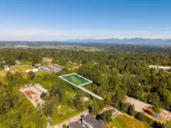
$2,700,000
7465 194 Street, Surrey, BC
0
sqft
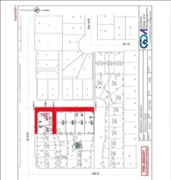
$3,399,000
18044 60 Avenue, Surrey, BC
0
sqft
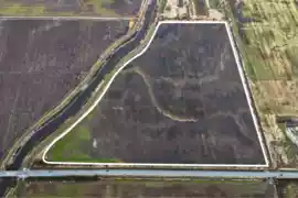
$3,650,000
17901 80 Avenue, Surrey, BC
0
sqft
$3,400,000
8171 176 Street, Surrey, BC
0
sqft
 7.7% price reduction
$2,998,000
4938 188 Street, Surrey, BC
0
sqft
$2,495,000
4115 184 Street, Surrey, BC
0
sqft
$3,099,000
6436 160 Street, Surrey, BC
0
sqft
 26.0% price reduction
$2,588,800
17356 101 Avenue, Surrey, BC
0
sqft
 8.6% price reduction
$3,195,000
3792 176 Street, Surrey, BC
0
sqft
 13.0% price reduction
$2,999,900
3271 196 Street, Surrey, BC
0
sqft
$3,199,000
15590 56 Avenue, Surrey, BC
0
sqft
 12.1% price reduction
$2,988,000
16429 40 Avenue, Surrey, BC
0
sqft
Copyright © 2013 - 2026 EstateBlock.com. All Rights Reserved. Renanza Realty Inc.
600-777 Hornby Street, Vancouver, BC V6Z 1S4. Call 778-918-5990.
600-777 Hornby Street, Vancouver, BC V6Z 1S4. Call 778-918-5990.
