By car (off-peak)
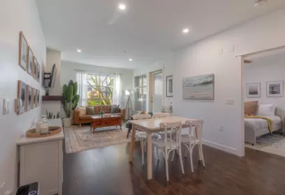
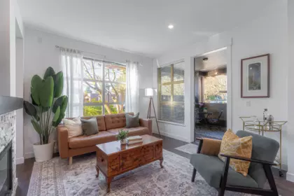
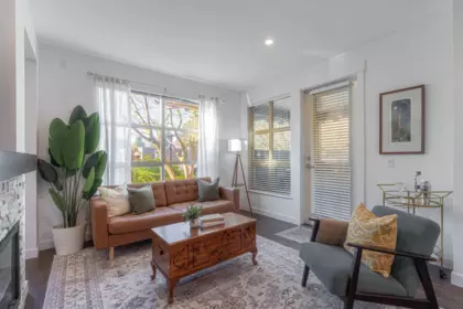
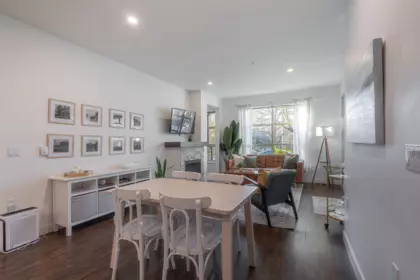
Sold
110 1468 St. Andrews Avenue, North Vancouver, BC
2
Beds
2
Baths
1023
sqft
2008
built

605 4730 Lougheed Highway, Burnaby, British Columbia V5C 0M9

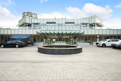
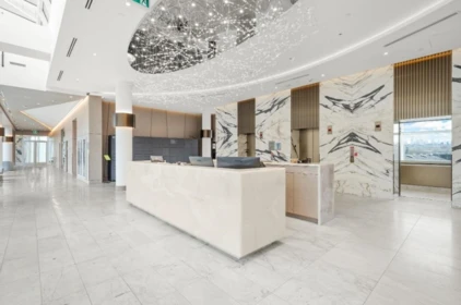
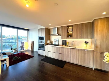
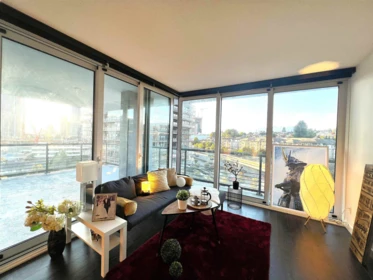


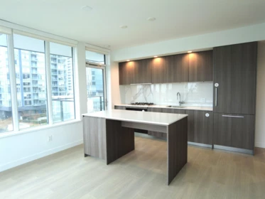
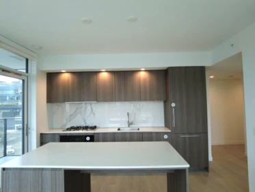
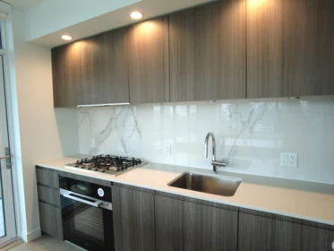
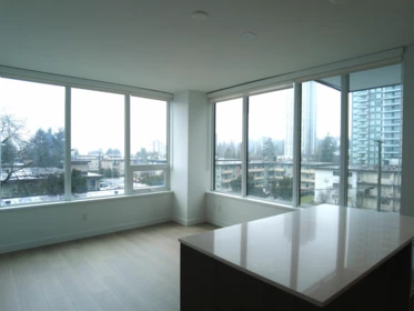
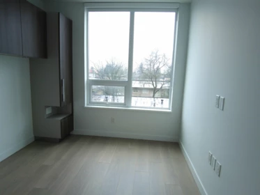
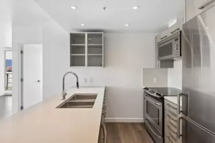
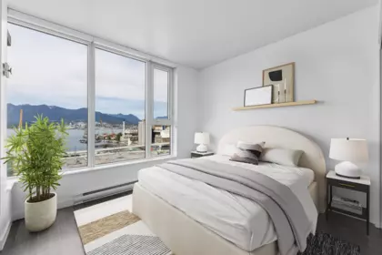
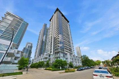
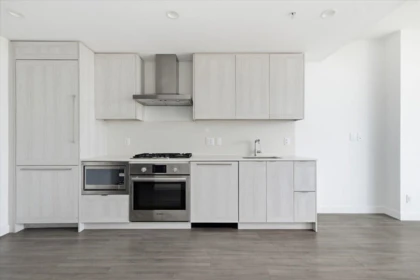
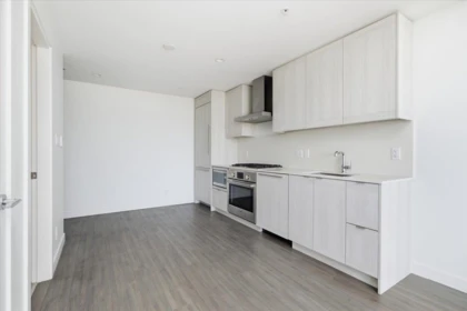
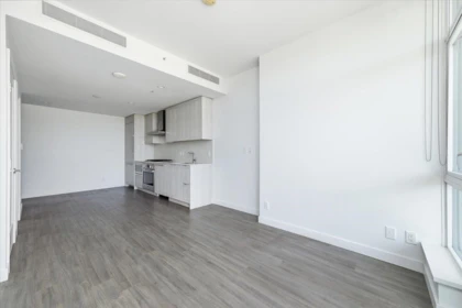
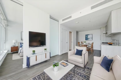
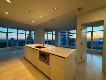
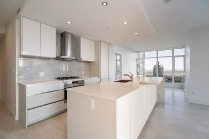
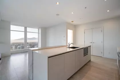
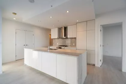
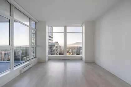
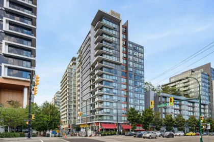
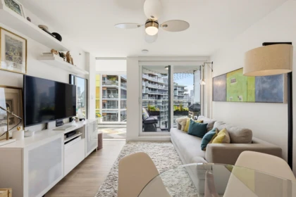
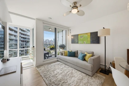
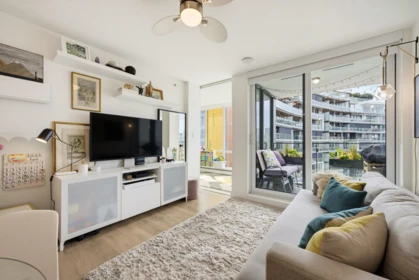
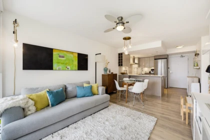
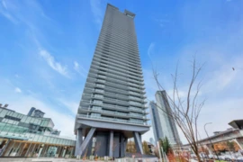
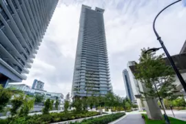
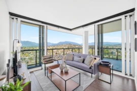
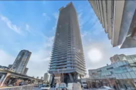
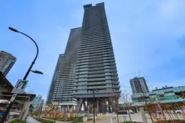
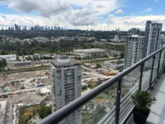
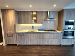
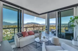
Hillside West by Concord Pacific - Like New! 2 bed 2 bath 757SF Corner Suite with HUGE wraparound Balcony (over 300sf!) and Panoramic Views! Indoor/outdoor living with large sliding glass doors that open the wall to the outside (with electric blinds). Features incl: Air Conditioning, 24/7 Concierge, high -end BOSCH appliances, Quartz countertops and beautiful flat panel cabinetry. Amenities incl: gym, theatre, piano room, dog wash, open green spaces, pathways, future urban park and outdoor beach. Close to Brentwood for Entertainment and Shopping. Easy access to SKYTRAIN. 2 Pets, 1 E/V ready PARKING, 1 LOCKER. Rentals ALLOWED!
| Basement Finished Area (sqft) | 0 |
|---|---|
| Basement Features | None |
| Appliances Included | Washer/Dryer, Dishwasher, Refrigerator, Stove, Microwave |
| Interior Features | Elevator |
| Heating Type | Geothermal |
| Cooling | Central Air |
| # of Kitchens | 0 |
| Foundation | Concrete Perimeter |
| Exterior Features | Playground, Balcony |
|---|---|
| View Description | CITY VIEWS |
| Structures | Multi Family, Residential Attached |
| Price | $698,888 |
|---|---|
| Total Bedrooms | 2 |
| Total Bathrooms | 2 |
| Full Bathrooms | 2 |
| Half Bathrooms | 0 |
| Floor Area Total (sqft) | 727 |
| Year Built | 2022 |
| Age Of Building | 4 |
| Building Type | Apartment/Condo |
| Property Type | Residential |
| Stories | 1 |
| Building Amenities | Clubhouse, Exercise Centre, Recreation Facilities, Concierge, Caretaker, Trash, Maintenance Grounds, Gas, Hot Water, Management, Geothermal |
| Ownership Type | Freehold Strata |
| Maintenance Fee | $460.51 |
| Community Features | Shopping Nearby |
| Amenities Nearby | Clubhouse, Exercise Centre, Recreation Facilities, Concierge, Caretaker, Trash, Maintenance Grounds, Gas, Hot Water, Management, Geothermal |
| Utility Type | Community, Natural Gas Connected |
| Utility Sewer | Public Sewer |
| Water (WaterSource) | Public |
| Parking Type | Underground |
| Total Parking Spaces | 1 |
| Strata Restrictions | Pets Allowed w/Rest.,Rentals Allwd w/Restrctns |
| Pet Restrictions | Yes With Restrictions |
| Units In Development | 892 |
| MLS® # | R3171174 |
|---|---|
| Area | Burnaby North |
| Neighbourhood | Brentwood Park |
| City | Burnaby |
| Postal Code | V5C 0M9 |
| Gross Taxes | $2,397.73 |
| Zoning | CD |
| Floor | Type | Dimensions |
|---|---|---|
| Main Level | Primary Bedroom | 10'7 x 10'7 ft |
| Main Level | Bedroom | 9'5 x 9'5 ft |
| Main Level | Living Room | 11'4 x 11'4 ft |
| Main Level | Dining Room | 11'0 x 11'0 ft |
| Main Level | Patio | 15'8 x 15'8 ft |
| Floor | Ensuite | Pieces |
|---|---|---|
| Main Level | Yes | #4 |
| Main Level | No | #3 |
Listed by: Coldwell Banker Prestige Realty
NOTE: This representation is based in whole or in part on data generated by the Chilliwack & District Real Estate Board, Fraser Valley Real Estate Board or Greater Vancouver REALTORS® which assumes no responsibility for its accuracy.
4720 Lougheed Highway, Brentwood Park, Burnaby
Hillside West building detailsBuilding
Bylaws on record
Market at Hillside West
$961/sqft, 6.9% below the building median of $1,032.
From MLS® and public strata records. Verify against the current Form B and registered bylaws.
Public Schools
Information includes BC Government Open License data; school details change often and are offered solely as general guidance.
Private Schools
Closest Transit
Crime Rate
Demographics
Noise/ Power Lines
Other
605 4730 Lougheed Highway has a sell-speed score of 53/100, placing it in the "Expected to sell at a moderate pace" band. The listing is priced 2.2% above comparable active properties in Brentwood Park. The local market is currently a Balanced Market with a sales-to-active ratio of 12.7% and an area average of 41 days on market — conditions are balanced. With only 551 competing homes currently listed, this property has significant competition. Based on these signals, EstateBlock predicts this listing is may take several weeks to attract serious offers.
Natural hazards vary by location and can change over time. The following provides a summary of potential impacts to this area, postal code V5C 0M9, over the next 30 years. Projections use the 2041–2070 period (2050s) under a moderate emissions scenario (SSP2-4.5).
Outside of designated flood hazard zones. Under 10% of buildings in this area have flood risk over the next 30 years.
Located within the "Vancouver" WUI zone (Risk Class 5 — Low). Based on BC Wildfire Service provincial WUI Risk Class mapping; not a site-specific assessment.
Annual avg PM2.5 4 µg/m³ — meets WHO 2021 guideline. Nearest station: Burnaby Kensington Park, Burnaby (~2.4 km). Annual avg AQHI 1.9 — Low Risk.
Burnaby currently sees ~1 day above 30 °C per year (1981–2010 baseline), projected to rise to ~7 by the 2050s (SSP2-4.5 moderate emissions). Hottest day of the year: ~30 °C baseline, ~32.4 °C projected. Tropical nights (>18 °C): ~0 baseline, ~3 projected.
Annual precipitation ~1393 mm (1981–2010 baseline), projected ~1445 mm by the 2050s. Extreme 1-day rainfall: ~47.8 mm baseline, ~53.3 mm projected. Values vary modestly across the Lower Mainland.
Longest annual dry spell (consecutive dry days): ~24 days baseline, ~25 days projected for the 2050s. CDD is used as a regional drought proxy; drought risk varies modestly across the Lower Mainland.


29 Schools are within 3km
| School | Type | Grades Served | Catchment Info | Rating | Distance |
|---|---|---|---|---|---|
Holy Cross School |
Independent |
Grades Served—
|
Catchment Info—
|
Distance689 m
|
|
Holy Cross Elementary School |
Independent |
Grades ServedK-7
|
Catchment Info—
|
Distance694 m
|
|
Brentwood Park Elementary School |
Public |
Grades ServedK-7
|
Catchment InfoIn Catchment
|
Distance752 m
|
|
Alpha Secondary |
Public |
Grades Served—
|
Catchment Info—
|
Distance1.27 KM
|
|
Parkcrest Elementary School |
Public |
Grades ServedK-7
|
Catchment Info—
|
Distance1.39 KM
|
|
Kitchener Elementary School |
Public |
Grades ServedK-7
|
Catchment Info—
|
Distance1.67 KM
|
|
Aubrey Elementary School |
Public |
Grades ServedK-7
|
Catchment Info—
|
Distance1.67 KM
|
|
Fawkes Academy |
Independent |
Grades Served—
|
Catchment Info—
|
Distance1.87 KM
|
|
Douglas Road Elementary |
Public |
Grades Served—
|
Catchment Info—
|
Distance2.02 KM
|
|
Confederation Park Elementary School |
Public |
Grades ServedK-7
|
Catchment Info—
|
Distance2.06 KM
|
|
Capitol Hill Elementary School |
Public |
Grades ServedK-7
|
Catchment Info—
|
Distance2.10 KM
|
|
Burnaby North Secondary School |
Public |
Grades Served8-12
|
Catchment Info—
|
Distance2.15 KM
|
|
Burnaby Continuing Education |
Public |
Grades Served—
|
Catchment Info—
|
Distance2.18 KM
|
|
Rosser Elementary School |
Public |
Grades ServedK-7
|
Catchment Info—
|
Distance2.22 KM
|
|
Fawkes Academy DL |
Independent |
Grades Served—
|
Catchment Info—
|
Distance2.23 KM
|
|
Sperling Elementary School |
Public |
Grades ServedK-7
|
Catchment Info—
|
Distance2.23 KM
|
|
Burnaby Montessori School |
Independent |
Grades ServedK-1
|
Catchment Info—
|
Distance2.24 KM
|
|
St. Helen's |
Independent |
Grades Served—
|
Catchment Info—
|
Distance2.36 KM
|
|
Whytecliff Agile Learning Centre-Burnaby |
Independent |
Grades Served—
|
Catchment Info—
|
Distance2.41 KM
|
|
Gilpin Elementary School |
Public |
Grades ServedK-7
|
Catchment Info—
|
Distance2.50 KM
|
|
Moscrop Secondary School |
Public |
Grades Served8-12
|
Catchment Info—
|
Distance2.51 KM
|
|
Gilmore Community Elementary School |
Public |
Grades ServedK-7
|
Catchment Info—
|
Distance2.54 KM
|
|
Lochdale Community Elementary |
Public |
Grades Served—
|
Catchment Info—
|
Distance2.61 KM
|
|
Vancouver Christian School |
Independent |
Grades ServedK-6
|
Catchment Info—
|
Distance2.69 KM
|
|
Vancouver Christian |
Independent |
Grades Served—
|
Catchment Info—
|
Distance2.70 KM
|
|
Burnaby Central Secondary |
Public |
Grades Served—
|
Catchment Info—
|
Distance2.75 KM
|
|
Cascade Heights Elementary |
Public |
Grades ServedK-7
|
Catchment Info—
|
Distance2.86 KM
|
|
Westridge Elementary School |
Public |
Grades ServedK-7
|
Catchment Info—
|
Distance2.88 KM
|
|
Sir John Franklin Community School |
Public |
Grades ServedK-7
|
Catchment Info—
|
Distance3.00 KM
|
Calculate your commute
605 4730 Lougheed Hwy, Burnaby, BC is ideally located for commuters. The property is 0.6 km from Brentwood, with a 27 min SkyTrain ride to Downtown Vancouver (Waterfront Station). The closest bus stop is Eastbound Lougheed Hwy @ Douglas Rd (0.27 km). Walk Score Transit rating: Excellent Transit (72/100).


Buy Vs Rent Calculator
Rent vs own
—
Based on 72 comparable active apartments/condos in Brentwood Park, the average asking price is $683,953. This listing is priced 2.2% above the neighbourhood average.

Potential Cashback for this listing if you buy with us
to track your cashback progress
Buy with us & save on this property
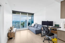
$608,000
3910 4880 Lougheed Highway, Burnaby, BC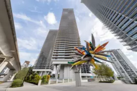
$799,000
3609 4880 Lougheed Highway, Burnaby, BC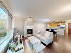
$639,999
207 4783 Dawson Street, Burnaby, BC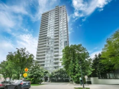 5.6% price reduction
$660,000
1006 2289 Yukon Crescent, Burnaby, BC
$688,000
2601 2289 Yukon Crescent, Burnaby, BC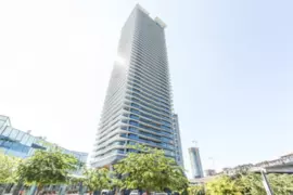
$758,000
3002 4720 Lougheed Highway, Burnaby, BC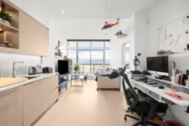
$598,800
4406 4720 Lougheed Highway, Burnaby, BC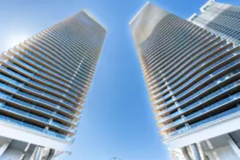
$778,000
1904 4890 Lougheed Highway, Burnaby, BC 5.9% price reduction
$799,900
1602 4890 Lougheed Highway, Burnaby, BC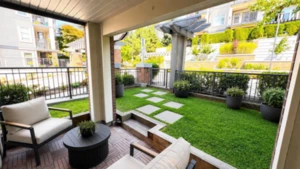
$659,000
106 4788 Brentwood Drive, Burnaby, BC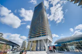
$749,900
1309 4890 Lougheed Highway, Burnaby, BC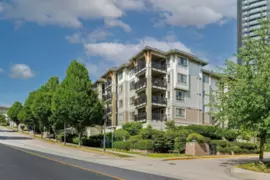 5.2% price reduction
$649,900
403 2088 Beta Avenue, Burnaby, BC