
12446 Old Yale Rd, Surrey BC – Land for Sale – MLS® R3099467
12446 Old Yale Road, Surrey, British Columbia V3V 3X8
Photos


Property Details for 12446 Old Yale Road
Prime Development Property located in one of Surrey’s most established industrial districts, Bridgeview. Excellent location for Industrial, Retail, Distribution centre and much more. Nearby access to Skytrain and major arterial and transportation networks. Surrey will continue to be the heart of Metro Vancouver’s growing population base and business community. IB Zoning allows for multiple uses such as Warehouse Operations, Offices, Assembly Halls, Child Care Centre etc. Next Door 12456 Old Yale Also for sale. Total Combined Land 19000sqft. See MLS# C8077089
Exterior Features
| Structures | Land Only |
|---|
Building Details
| Price | $2,249,999 |
|---|---|
| Property Type | Land |
| Ownership Type | Freehold NonStrata |
| Utility Type | Sanitary Sewer Available, Storm Sewer Available, Electricity At Lot Line, Natural Gas Available, Natural Gas Connected, Cable Connected |
| Water (WaterSource) | Public |
Lot & Land
| Lot Size | 12000 |
|---|---|
| Lot Size Depth | Feet |
| Lot Size Frontage | 77 |
| MLS® # | R3099467 |
| Area | North Surrey |
| Neighbourhood | Bridgeview |
| City | Surrey |
| Postal Code | V3V 3X8 |
| Gross Taxes | $21,770.16 |
| Zoning | IB |
Property Timeline
Listed by: YPA Your Property Agent
NOTE: This representation is based in whole or in part on data generated by the Chilliwack & District Real Estate Board, Fraser Valley Real Estate Board or Greater Vancouver REALTORS® which assumes no responsibility for its accuracy.
Map & Neighbourhood
Public Schools
- Secondary
- L A Matheson Secondary School
- 2.42 km
- Elementary
- Prince Charles Elementary School
- Below Average 1.37 km
Information includes BC Government Open License data; school details change often and are offered solely as general guidance.
Private Schools
- Elementary, Secondary
- Khalsa School (Surrey)
- 0.32 km
- Elementary, Secondary
- Khalsa School (Surrey)
- 0.32 km
Closest Transit
- Bus Stop
- Northbound Scott Rd @ Old Yale Rd
- 0.45 km
- Skytrain
- Skytrain @ Scott Road Stn
- 0.82 km
Crime Rate
- Total Crime Rate
- Average
- Violent Crime Rate
- Below Average
- Property Crime Rate
- Average
Demographics
- Post-Secondary Education
- Below Average 11.7%
- No Certificate/Degree
- Above Average 25%
- Owner Occupied
- Average 61.8%
- Employment Rate
- Above Average 69.2%
Noise/ Power Lines
- Road/Hwy Noise
- Possible
- Railway/Sky train Noise
- Unlikely
- Airport/Port Noise
- Unlikely
- Close to major Power Lines
- Unlikely
Other
- Agricultural Land Reserve (ALR)
- Unlikely
- Flood Area
- Unlikely
- Close to Cemeteries
- Unlikely
Sell Speed & Competition
12446 Old Yale Road has a sell-speed score of 30/100, placing it in the "May take longer than the area average to sell" band. The listing is priced 48.4% above comparable active properties in Bridgeview. Based on these signals, EstateBlock predicts this listing is could take longer than the area average to sell.
Climate Risk for V3V 3X8
Natural hazards vary by location and can change over time. The following provides a summary of potential impacts to this area, postal code V3V 3X8, over the next 30 years. Projections use the 2041–2070 period (2050s) under a moderate emissions scenario (SSP2-4.5).
Outside of designated flood hazard zones. Under 10% of buildings in this area have flood risk over the next 30 years.
Located within the "Vancouver" WUI zone (Risk Class 5 — Low). Based on BC Wildfire Service provincial WUI Risk Class mapping; not a site-specific assessment.
Annual avg PM2.5 5.2 µg/m³ — meets Canada's CAAQS. Nearest station: New Westminster Sapperton Park, New Westminster (~3.6 km). Annual avg AQHI 0 — Low Risk.
Surrey currently sees ~1 day above 30 °C per year (1981–2010 baseline), projected to rise to ~8 by the 2050s (SSP2-4.5 moderate emissions). Hottest day of the year: ~30 °C baseline, ~32.5 °C projected. Tropical nights (>18 °C): ~0 baseline, ~3 projected.
Annual precipitation ~1516 mm (1981–2010 baseline), projected ~1574 mm by the 2050s. Extreme 1-day rainfall: ~51.5 mm baseline, ~57.1 mm projected. Values vary modestly across the Lower Mainland.
Longest annual dry spell (consecutive dry days): ~23 days baseline, ~24 days projected for the 2050s. CDD is used as a regional drought proxy; drought risk varies modestly across the Lower Mainland.
Nearby Restaurants, Cafes & Shops

Shopping (3 nearby)
- Metrolife pharmacy · 770 m · Pharmacy
- Anytime coffee express · 873 m · Kiosk
- Gc barbershop · 873 m · Hairdresser

Cafes (3 nearby)
- Anytime coffee · 815 m · Cafe
- Chai coffee company · 890 m · Cafe
- Tim hortons · 968 m · Cafe

Restaurants (2 nearby)
- Subway · 699 m · Fast Food
- Pizza pizza · 778 m · Fast Food

Transit (2 nearby)
- Skytrain @ scott road stn station · 818 m · Transit
- Bus stop westbound 111a ave @ 12300 block · 1000 m · Transit

Gyms (1 nearby)
- The hive surrey · 926 m · Gym

Healthcare (1 nearby)
- Metrolife pharmacy · 770 m · Healthcare
Schools NearBy
19 Schools are within 3km
| School | Type | Grades Served | Catchment Info | Rating | Distance |
|---|---|---|---|---|---|
K B Woodward Elementary School |
Public |
Grades ServedK-7
|
Catchment Info—
|
Distance1.36 KM
|
|
Prince Charles Elementary School |
Public |
Grades ServedK-7
|
Catchment InfoIn Catchment
|
Distance1.37 KM
|
|
City Central Learning Centre |
Public |
Grades Served10-12
|
Catchment Info—
|
Distance1.39 KM
|
|
Kwantlen Park Secondary School |
Public |
Grades Served8-12
|
Catchment Info—
|
Distance1.50 KM
|
|
Cedar Hills Elementary School |
Public |
Grades ServedK-7
|
Catchment Info—
|
Distance1.85 KM
|
|
Old Yale Road Elementary School |
Public |
Grades ServedK-7
|
Catchment Info—
|
Distance1.87 KM
|
|
L A Matheson Secondary School |
Public |
Grades Served8-12
|
Catchment InfoIn Catchment
|
Distance2.42 KM
|
|
Purpose Independent Secondary School |
Independent |
Grades Served8-12
|
Catchment Info—
|
Distance2.53 KM
|
|
Royal Heights Elementary School |
Public |
Grades ServedK-7
|
Catchment Info—
|
Distance2.55 KM
|
|
Bridgeview Elementary School |
Public |
Grades ServedK-7
|
Catchment Info—
|
Distance2.59 KM
|
|
Compass Christian New West |
Independent |
Grades Served—
|
Catchment Info—
|
Distance2.63 KM
|
|
Al-Hidayah School |
Independent |
Grades Served—
|
Catchment Info—
|
Distance2.67 KM
|
|
Senator Reid Elementary School |
Public |
Grades ServedK-7
|
Catchment Info—
|
Distance2.72 KM
|
|
New Westminster Online Schools |
Public |
Grades Served—
|
Catchment Info—
|
Distance2.74 KM
|
|
James Ardiel Elementary School |
Public |
Grades ServedK-7
|
Catchment Info—
|
Distance2.84 KM
|
|
Betty Huff Elementary School |
Public |
Grades ServedK-7
|
Catchment Info—
|
Distance2.94 KM
|
|
Forsyth Road Elementary School |
Public |
Grades ServedK-7
|
Catchment Info—
|
Distance2.96 KM
|
|
Fraser River Middle |
Public |
Grades Served—
|
Catchment Info—
|
Distance2.96 KM
|
|
Our Lady of Good Counsel |
Independent |
Grades ServedK-7
|
Catchment Info—
|
Distance2.97 KM
|
Pre-computed routes from 12446 Old Yale Rd, Surrey, BC

By transit (Skytrain)
-
Downtown Vancouver via Scott Road → Waterfront46 min
-
Metrotown, Burnaby via Scott Road → Metrotown28 min
-
SFU Burnaby via Scott Road → Production Way26 min
-
Richmond Centre via Scott Road → Brighouse71 min
-
YVR Airport via Scott Road → YVR-Airport72 min
By car (off-peak)
 By car (off-peak)
-
Downtown Vancouver via HWY 1 / Grandview24 min
-
Metrotown, Burnaby via Lougheed Hwy12 min
-
SFU Burnaby via Gaglardi Way8 min
-
Richmond Centre via No. 3 Rd23 min
-
YVR Airport via Bridgeport / Sea Island26 min
Calculate your commute
12446 Old Yale Rd, Surrey, BC is ideally located for commuters. The property is 0.8 km from Scott Road, with a 46 min SkyTrain ride to Downtown Vancouver (Waterfront Station). The closest bus stop is Northbound Scott Rd @ Old Yale Rd (0.45 km). Walk Score Transit rating: Excellent Transit (76/100).
Walkability & Transit Near 12446 Old Yale Road

Walk Score - Car-Dependent

Transit Score - Excellent Transit

Bikeable 51
Bike Score - Bikeable
BC Assessment Value — 12446 Old Yale Road
| Year | Land | Improvements | Total Assessed | YOY Change |
|---|---|---|---|---|
| 2026 | $1,844,000 | $0 | $1,844,000 | — |
Mortgage Calculator for 12446 Old Yale Road
Investment Cashflow Calculator
Estateblock Rent Estimate for 12446 Old Yale Road, Surrey
Buy Vs Rent Calculator
Rent vs own
—
Price vs Neighbourhood Average — Bridgeview, Surrey
Comparable data is unavailable at the neighbourhood level. City-wide in Surrey, similar properties average $1,515,839 across 33 active listings — this listing is 48.4% above the Surrey average.
Call or Text Now!

Earn Cashback on Your Purchase
Potential Cashback for this listing if you buy with us
to track your cashback progress
Buy with us & save on this property
Similar Land for Sale in Surrey
 16.1% price reduction
$2,500,000
10951 Haddon Road, Surrey, BC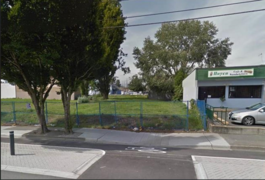
$2,130,000
13535 105a Avenue, Surrey, BC
$2,000,000
10636 137a Street, Surrey, BC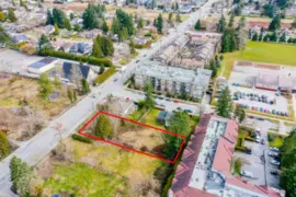
$2,175,000
13878 108 Avenue, Surrey, BC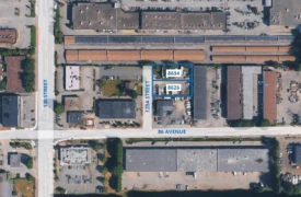 22.0% price reduction
$1,950,000
8626 8634 120a Street, Surrey, BC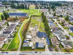
$2,199,000
12490 66 Avenue, Surrey, BC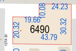
$1,900,000
6490 127a Street, Surrey, BC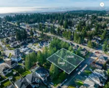 20.0% price reduction
$2,520,000
13630 & 13644 60 Avenue, Surrey, BC 26.0% price reduction
$2,588,800
17356 101 Avenue, Surrey, BC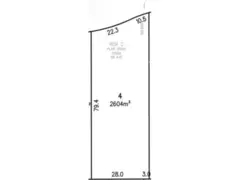
$2,225,000
12982 57b Avenue, Surrey, BC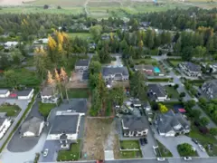
$2,098,000
13088 57 Avenue, Surrey, BC
$2,199,999
5552 125 Street, Surrey, BC600-777 Hornby Street, Vancouver, BC V6Z 1S4. Call 778-918-5990.
