
14188 62b Ave, Surrey BC V3X 0B3 – House for Sale – MLS® R3183925
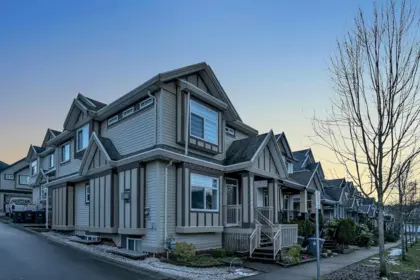


Property Details for 14188 62b Avenue
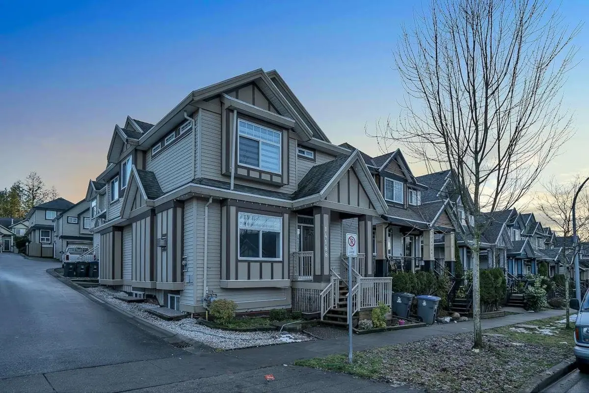
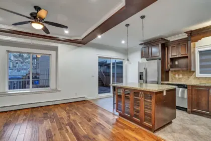
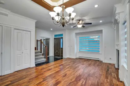
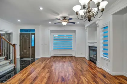
Located in the quiet neighbourhood of Sullivan Station, this 2008-built home on a corner lot features... It offers 7 bedrooms and 5 bathrooms on a spacious lot. Two rental units: a 2-bedroom basement suite and a 1-bedroom coach house. Enjoy high-quality finishes and abundant natural light. The main features include a living room, dining room, family room, kitchen, and a powder room. The kitchen boasts granite countertops and stainless steel appliances. There's a covered sundeck for summer entertaining. Upstairs, there are 4 bedrooms and 2 full bathrooms. Access the double garage from the back lane, plus enjoy additional parking and street parking. McLeod Road Traditional Elementary, other elementary schools, and Sullivan Heights Secondary, and the shopping mall.
Building Details
| Price | $1,365,555 |
|---|---|
| Total Bedrooms | 7 |
| Total Bathrooms | 5 |
| Full Bathrooms | 4 |
| Half Bathrooms | 1 |
| Floor Area Total (sqft) | 2792 |
| Year Built | 2008 |
| Age Of Building | 18 |
| Building Type | Single Family Residence |
| Property Type | Residential |
| Architecture Style | Carriage/Coach House |
| Stories | 2 |
| Ownership Type | Freehold NonStrata |
| Community Features | Independent living, Shopping Nearby |
| Utility Type | Community, Electricity Connected, Natural Gas Connected, Water Connected |
| Utility Sewer | Public Sewer, Sanitary Sewer, Storm Sewer |
| Water (WaterSource) | Public |
| Parking Type | Garage Double, Rear Access, Concrete |
| Total Parking Spaces | 5 |
| Rental Suites | Unauthorized Suite |
Interior Features
| Basement Finished Area (sqft) | 792 |
|---|---|
| Basement Features | Finished, Exterior Entry |
| Appliances Included | Washer/Dryer, Dishwasher, Refrigerator, Stove, Microwave |
| Interior Features | Central Vacuum |
| Fireplace | 1 |
| Heating Type | Baseboard, Hot Water, Natural Gas |
| Laundry | Common Area |
| # of Kitchens | 3 |
| Flooring | Hardwood, Wall/Wall/Mixed |
| Foundation | Concrete Perimeter |
Exterior Features
| Roof | Asphalt |
|---|---|
| Structures | Residential Detached |
Lot & Land
| Lot Size | 2821 |
|---|---|
| Lot Size Depth | Feet |
| Lot Size Frontage | 28.2 |
| MLS® # | R3183925 |
| Area | Surrey |
| Neighbourhood | Sullivan Station |
| City | Surrey |
| Postal Code | V3X 0B3 |
| Gross Taxes | $6,360.49 |
| Zoning | RF-9C |
Property Timeline
Greater Vancouver REALTORS® MLS® data via EstateBlock, updated Nov 22, 2026.
Rooms
| Floor | Type | Dimensions |
|---|---|---|
| Main Level | Living Room | 14'5 x 14'5 ft |
| Main Level | Kitchen | 12' x 12' ft |
| Main Level | Family Room | 15' x 15' ft |
| Main Level | Dining Room | 12'5 x 12'5 ft |
| Main Level | Foyer | 6'5 x 6'5 ft |
Bathrooms
| Floor | Ensuite | Pieces |
|---|---|---|
| Main Level | No | #2 |
| Above Level | Yes | #5 |
| Above Level | No | #4 |
Listed by: eXp Realty of Canada Inc.
NOTE: This representation is based in whole or in part on data generated by the Chilliwack & District Real Estate Board, Fraser Valley Real Estate Board or Greater Vancouver REALTORS® which assumes no responsibility for its accuracy.
14188 62b Ave, Surrey, BC: summary
14188 62b Ave, Surrey, BC (MLS® R3183925) has 7 bedrooms, 5 bathrooms and 2,792 sq ft, and is listed at $1,365,555. This 2008 house came on the market November 16, 2026 and has been on the market for 6 days.
Climate and land risk for 14188 62b Ave: flood risk is unlikely, and postal code V3X 0B3 is rated lower risk for flood over the next 30 years. Wildfire risk is low. Air quality grades A (PM2.5 4.5 µg/m³). Surrey sees about 1 day a year above 30°C, projected to reach 8 by the 2050s. ALR: no.
Noise and nearby uses: road noise is possible, SkyTrain noise unlikely, airport noise unlikely; major power lines are unlikely, and a cemetery nearby is unlikely. Crime is average, with violent crime below average and property crime average.
Schools for 14188 62b Ave: Goldstone Park Elementary is the catchment elementary (5.6/10, 0.80 km), and Sullivan Heights Secondary the catchment secondary (6.5/10, 0.48 km). Walk Score 67, Transit Score 43.
Carrying cost with 20% down at 4.7% is about $6,196 a month, including $6,360 in 2026 property taxes. EstateBlock's rent estimate is $5,419; an investor would be $1,222 a month short and owning runs about $641 a month less than renting once $1,387 of principal is counted.
14188 62b Ave sits on a 2,821 sq ft lot, zoned RF-9C with 28.2 ft of frontage. In Sullivan Station, 92.1% of homes are owner-occupied, 25.5% of adults have post-secondary education and employment is 78.8%.
Map, sell speed & climate
SkyTrain 5.81 km · Sullivan Heights Secondary School 6.5/10 · 0.48 km · crime average · flood lower risk · wildfire low
Map & Neighbourhood
Nearby Restaurants, Cafes & Shops

Restaurants (5 nearby)
- Triple o's · 434 m · Fast Food
- Subway · 451 m · Fast Food
- Popeyes · 480 m · Fast Food

Shopping (2 nearby)
- South newton · 130 m · Post Office
- Pharmasave · 136 m · Pharmacy

Groceries (1 nearby)
- 7-eleven · 587 m · Convenience

Cafes (1 nearby)
- Tim hortons · 583 m · Cafe

Healthcare (1 nearby)
- Pharmasave · 136 m · Healthcare

Transit (1 nearby)
- Bus stop southbound 144 st @ 67a ave · 999 m · Transit
Public Schools
Information includes BC Government Open License data; school details change often and are offered solely as general guidance.
Source: EstateBlock school rating, computed from BC Ministry of Education and Child Care school reports, 2025/2026.
Private Schools
Source: EstateBlock school rating, computed from BC Ministry of Education and Child Care school reports, 2025/2026.
Closest Transit
Source: TransLink GTFS, Dec 2025.
Crime Rate
Source: RCMP Surrey detachment open data, 2020.
Demographics
Noise / Power Lines
Other
Sell Speed & Competition
Climate Risk for V3X 0B3
Natural hazards vary by location and can change over time. The following provides a summary of potential impacts to this area, postal code V3X 0B3, over the next 30 years. Projections use the 2041–2070 period (2050s) under a moderate emissions scenario (SSP2-4.5).
Outside of designated flood hazard zones. Under 10% of buildings in this area have flood risk over the next 30 years.
Located within the "Vancouver" WUI zone (Risk Class 5 — Low). Based on BC Wildfire Service provincial WUI Risk Class mapping; not a site-specific assessment.
Annual avg PM2.5 4.5 µg/m³ — meets WHO 2021 guideline. Nearest station: North Delta, Delta (~7 km). Annual avg AQHI 2.1 — Low Risk.
Surrey currently sees ~1 day above 30 °C per year (1981–2010 baseline), projected to rise to ~8 by the 2050s (SSP2-4.5 moderate emissions). Hottest day of the year: ~30 °C baseline, ~32.5 °C projected. Tropical nights (>18 °C): ~0 baseline, ~3 projected.
Annual precipitation ~1516 mm (1981–2010 baseline), projected ~1574 mm by the 2050s. Extreme 1-day rainfall: ~51.5 mm baseline, ~57.1 mm projected. Values vary modestly across the Lower Mainland.
Longest annual dry spell (consecutive dry days): ~23 days baseline, ~24 days projected for the 2050s. CDD is used as a regional drought proxy; drought risk varies modestly across the Lower Mainland.
Source: BC Wildfire Service, provincial WUI Risk Class map, 2026.
Source: BC Air Quality monitoring network, North Delta station, 2024 annual average.
Source: ClimateData.ca (PCIC / Environment and Climate Change Canada), 1981–2010 baseline, SSP2-4.5.
Schools NearBy
24 Schools are within 3km
| School | Type | Grades Served | Catchment Info | Rating | Distance |
|---|---|---|---|---|---|
McLeod Road Traditional School |
Public |
Grades ServedK-7
|
Catchment Info—
|
Distance102 m
|
|
Woodward Hill Elementary School |
Public |
Grades ServedK-7
|
Catchment Info—
|
Distance400 m
|
|
Sullivan Heights Secondary School |
Public |
Grades Served8-12
|
Catchment InfoIn Catchment
|
Distance484 m
|
|
Goldstone Park Elementary School |
Public |
Grades ServedK-7
|
Catchment InfoIn Catchment
|
Distance796 m
|
|
Hyland Elementary School |
Public |
Grades ServedK-7
|
Catchment Info—
|
Distance910 m
|
|
Georges Vanier Elementary School |
Public |
Grades ServedK-7
|
Catchment Info—
|
Distance1.42 KM
|
|
North Ridge Elementary School |
Public |
Grades ServedK-7
|
Catchment Info—
|
Distance1.44 KM
|
|
Henry Bose Elementary School |
Public |
Grades ServedK-7
|
Catchment Info—
|
Distance1.62 KM
|
|
Cambridge Elementary School |
Public |
Grades ServedK-7
|
Catchment Info—
|
Distance1.64 KM
|
|
Regent Christian Online Academy |
Independent |
Grades Served—
|
Catchment Info—
|
Distance1.98 KM
|
|
Regent Christian Academy |
Independent |
Grades ServedK-12
|
Catchment Info—
|
Distance2.00 KM
|
|
T E Scott Elementary School |
Public |
Grades ServedK-7
|
Catchment Info—
|
Distance2.03 KM
|
|
M B Sanford Elementary School |
Public |
Grades ServedK-7
|
Catchment Info—
|
Distance2.14 KM
|
|
St. Bernadette |
Independent |
Grades ServedK-7
|
Catchment Info—
|
Distance2.15 KM
|
|
St Bernadette |
Independent |
Grades Served—
|
Catchment Info—
|
Distance2.18 KM
|
|
Sullivan Elementary School |
Public |
Grades ServedK-7
|
Catchment Info—
|
Distance2.21 KM
|
|
W E Kinvig Elementary School |
Public |
Grades ServedK-7
|
Catchment Info—
|
Distance2.38 KM
|
|
Gabrielle-Roy |
Public |
Grades Served—
|
Catchment Info—
|
Distance2.47 KM
|
|
Chimney Hill Elementary School |
Public |
Grades ServedK-7
|
Catchment Info—
|
Distance2.57 KM
|
|
Panorama Park Elementary School |
Public |
Grades ServedK-7
|
Catchment Info—
|
Distance2.65 KM
|
|
McLeod Road Traditional |
Public |
Grades Served—
|
Catchment Info—
|
Distance2.66 KM
|
|
Martha Jane Norris Elementary School |
Public |
Grades ServedK-7
|
Catchment Info—
|
Distance2.66 KM
|
|
Surrey Muslim School |
Independent |
Grades ServedK-7
|
Catchment Info—
|
Distance2.80 KM
|
|
Frank Hurt Secondary School |
Public |
Grades Served8-12
|
Catchment Info—
|
Distance2.88 KM
|
Source: EstateBlock school rating, computed from BC Ministry of Education and Child Care school reports, 2025/2026.
Walkability & Transit Near 14188 62b Avenue

Walk Score - Somewhat Walkable

Transit Score - Some Transit

Bike Score - Somewhat Bikeable
Source: Walk Score.
BC Assessment Value — 14188 62b Avenue
| Year | Land | Improvements | Total Assessed | YOY Change |
|---|---|---|---|---|
| 2026 | $949,000 | $335,000 | $1,284,000 | — |
Source: City of Surrey Open Data, property assessment dataset, 2026 roll.
Costs & calculators
Monthly cost about $6,196/month · rent estimate $5,419/month · owning nets $641/month less than renting · cash flow if rented −$1,222/month
Mortgage Calculator for 14188 62b Avenue
The estimated monthly cost of 14188 62b Avenue, Surrey is $6,196: $5,666 principal and interest with 20% down over 30 years at 4.7%, plus $530 property tax.
Investment Cashflow Calculator
If 14188 62b Avenue, Surrey were rented at $5,419 a month with 5% vacancy, it would fall $1,222 a month short of the mortgage and carrying costs; about 38% down would break even.
Estateblock Rent Estimate for 14188 62b Avenue, Surrey
Example shown is the principal portion at year 5 of the mortgage. It grows over the loan: ~$1,417/mo (year 1) → ~$3,456/mo (year 20) → ~$5,271/mo (year 29).
EstateBlock estimates 14188 62b Avenue, Surrey would rent for about $5,419 a month.
Rent vs own: 14188 62b Avenue
Rent vs own
Owning nets $641/mo less than renting
With 20% down ($273,111) at 4.7%: $4,778/mo net cost to own in year 1 vs $5,419/mo rent
Assumes 20% down payment, 4.7% fixed rate, 30-year amortization. Rent line = full rent (money gone). Own line = interest + property tax + fees, excluding principal (money you keep as equity). No appreciation, investment returns or transaction costs included.
Owning 14188 62b Avenue, Surrey nets about $641 a month less than renting it in year 1, with $93,612 of principal paid off by year 5 and $211,968 by year 10.
Price vs Neighbourhood Average — Sullivan Station, Surrey
No active comparable properties are currently available for this property type in Surrey. The price evaluation chart will update as similar listings enter the market.
Greater Vancouver REALTORS® MLS® data via EstateBlock, updated Nov 22, 2026.
Call or Text Now!

Earn Cashback on Your Purchase
Potential Cashback for this listing if you buy with us
to track your cashback progress
Buy with us & save on this property
14188 62b Ave for sale FAQ
Does 14188 62b Ave have flood risk?
Flood risk at 14188 62b Ave is unlikely, and postal code V3X 0B3 is rated lower risk for flood over the next 30 years.
What are the catchment schools for 14188 62b Ave?
The catchment elementary is Goldstone Park Elementary (5.6/10, 0.80 km), and the catchment secondary is Sullivan Heights Secondary (6.5/10, 0.48 km).
What is the crime rate near 14188 62b Ave?
Total crime near 14188 62b Ave is average: violent crime is below average and property crime is average.
Is 14188 62b Ave near a highway, SkyTrain line or power lines?
Road noise is possible, SkyTrain noise unlikely, and airport noise unlikely. Major power lines nearby are unlikely.
What is the lot size of 14188 62b Ave?
The lot is 2,821 sq ft, zoned RF-9C.
Do you need a car at 14188 62b Ave?
The Walk Score is 67 and the Transit Score 43.
What is the wildfire risk and air quality at 14188 62b Ave?
Wildfire risk is low and air quality grades A. Surrey sees about 1 day a year above 30°C, projected to reach 8 by the 2050s.
How much rent could 14188 62b Ave bring in?
About $5,419 a month by EstateBlock's estimate, a shortfall of $1,222 a month at 20% down.
How long has 14188 62b Ave been on the market?
It was listed on November 16, 2026 and has been on the market for 6 days.
Similar Single Family Residences for Sale in Sullivan Station
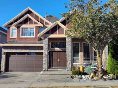 11.1% price reduction
$1,538,000
14197 62b Avenue, Surrey, BC
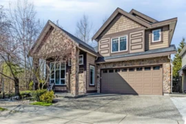
$1,494,900
14255 62b Avenue, Surrey, BC
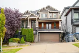 5.3% price reduction
$1,599,900
6158 140b Street, Surrey, BC
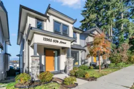
$1,549,900
13963 60 Avenue, Surrey, BC
600-777 Hornby Street, Vancouver, BC V6Z 1S4. Call 778-918-5990.
About EstateBlock · Who reviews our guides
