
14 W 14th Ave, Vancouver, BC – Duplex, Off market
14 W 14th Avenue, Vancouver, British Columbia V5Y 1W6

Map, sell speed & climate
SkyTrain 0.84 km · crime average · sell-speed score 42/100 (may take longer) · flood lower risk · wildfire low
VERIFIED ACCOUNT REQUIRED
Map & Neighbourhood
Nearby Restaurants, Cafes & Shops

Shopping (163 nearby)
- Save on cleaners · 269 m · Laundry
- Print express · 273 m · Post Office
- Pure integrative pharmacy · 286 m · Pharmacy

Restaurants (133 nearby)
- Pizza garden · 293 m · Restaurant
- Kaori izakaya · 294 m · Restaurant
- Pho goodness · 298 m · Restaurant

Cafes (34 nearby)
- Forecast · 333 m · Cafe
- Caffè mira · 362 m · Cafe
- The federal store · 439 m · Cafe

Groceries (32 nearby)
- Save-on-foods · 263 m · Supermarket
- Snack land! · 292 m · Convenience
- Cobs · 339 m · Bakery

Healthcare (16 nearby)
- Pure integrative pharmacy · 286 m · Healthcare
- Shoppers drug mart · 415 m · Healthcare
- Westin pharmacy · 548 m · Healthcare

Transit (2 nearby)
- Skytrain @ broadway-city hall stn station · 838 m · Transit
- Bus stop broadway-city hall station @ bay 1 · 936 m · Transit
Public Schools
Information includes BC Government Open License data; school details change often and are offered solely as general guidance.
Source: EstateBlock school rating, computed from BC Ministry of Education and Child Care school reports, 2025/2026.
Private Schools
Source: EstateBlock school rating, computed from BC Ministry of Education and Child Care school reports, 2025/2026.
Closest Transit
Source: TransLink GTFS, Dec 2025.
Crime Rate
Source: Vancouver Police Department open data, 2020.
Demographics
Noise / Power Lines
Other
Sell Speed & Competition
14 W 14th Avenue has a sell-speed score of 42/100, placing it in the "May take longer than the area average to sell" band. The local market is currently a Buyer's Market with a sales-to-active ratio of 11.1% and an area average of 56 days on market — buyers have more leverage. With 216 competing homes currently listed, this property has significant competition. Based on these signals, EstateBlock predicts this listing is could take longer than the area average to sell.
EstateBlock sell-speed model, computed from Greater Vancouver MLS® history, updated daily.
Climate Risk for V5Y 1W6
Natural hazards vary by location and can change over time. The following provides a summary of potential impacts to this area, postal code V5Y 1W6, over the next 30 years. Projections use the 2041–2070 period (2050s) under a moderate emissions scenario (SSP2-4.5).
Outside of designated flood hazard zones. Under 10% of buildings in this area have flood risk over the next 30 years.
Located within the "Vancouver" WUI zone (Risk Class 5 — Low). Based on BC Wildfire Service provincial WUI Risk Class mapping; not a site-specific assessment.
Annual avg PM2.5 5.1 µg/m³ — meets Canada's CAAQS. Nearest station: Vancouver Clark Drive, Vancouver (~2 km). Annual avg AQHI 2.2 — Low Risk.
Vancouver currently sees ~1 day above 30 °C per year (1981–2010 baseline), projected to rise to ~6 by the 2050s (SSP2-4.5 moderate emissions). Hottest day of the year: ~29.7 °C baseline, ~32 °C projected. Tropical nights (>18 °C): ~0 baseline, ~4 projected.
Annual precipitation ~1515 mm (1981–2010 baseline), projected ~1575 mm by the 2050s. Extreme 1-day rainfall: ~50.5 mm baseline, ~57 mm projected. Values vary modestly across the Lower Mainland.
Longest annual dry spell (consecutive dry days): ~22 days baseline, ~24 days projected for the 2050s. CDD is used as a regional drought proxy; drought risk varies modestly across the Lower Mainland.
Source: BC Wildfire Service, provincial WUI Risk Class map, 2026.
Source: BC Air Quality monitoring network, Vancouver Clark Drive station, 2024 annual average.
Source: ClimateData.ca (PCIC / Environment and Climate Change Canada), 1981–2010 baseline, SSP2-4.5.
Schools NearBy
52 Schools are within 3km
| School | Type | Grades Served | Catchment Info | Rating | Distance |
|---|---|---|---|---|---|
Simon Fraser Elementary School |
Public |
Grades ServedK-7
|
Catchment InfoIn Catchment
|
Distance233 m
|
|
St.Patrick's Elementary School |
Independent |
Grades ServedK-7
|
Catchment Info—
|
Distance256 m
|
|
St Patrick's |
Independent |
Grades Served—
|
Catchment Info—
|
Distance322 m
|
|
St.Patrick Regional Secondary School |
Independent |
Grades Served8-12
|
Catchment Info—
|
Distance409 m
|
|
Florence Nightingale Elementary School |
Public |
Grades ServedK-7
|
Catchment Info—
|
Distance826 m
|
|
David Livingstone Elementary School |
Public |
Grades ServedK-7
|
Catchment Info—
|
Distance1.00 KM
|
|
Mount Pleasant Elementary School |
Public |
Grades ServedK-7
|
Catchment Info—
|
Distance1.02 KM
|
|
Blessed Sacrament School |
Independent |
Grades ServedK-7
|
Catchment Info—
|
Distance1.03 KM
|
|
Edith Cavell Elementary School |
Public |
Grades ServedK-7
|
Catchment Info—
|
Distance1.05 KM
|
|
St Francis Xavier |
Independent |
Grades Served—
|
Catchment Info—
|
Distance1.17 KM
|
|
St. Francis Xavier |
Independent |
Grades ServedK-7
|
Catchment Info—
|
Distance1.20 KM
|
|
General Wolfe Elementary School |
Public |
Grades ServedK-7
|
Catchment Info—
|
Distance1.21 KM
|
|
Eaton Arrowsmith School (Vancouver) Ltd |
Independent |
Grades Served—
|
Catchment Info—
|
Distance1.40 KM
|
|
Canada Royal Arts High School |
Independent |
Grades Served—
|
Catchment Info—
|
Distance1.48 KM
|
|
Columbia College |
Independent |
Grades Served11-12
|
Catchment Info—
|
Distance1.66 KM
|
|
Charles Dickens Elementary School |
Public |
Grades ServedK-7
|
Catchment Info—
|
Distance1.67 KM
|
|
Emily Carr Elementary School |
Public |
Grades ServedK-7
|
Catchment Info—
|
Distance1.81 KM
|
|
False Creek Elementary |
Public |
Grades Served—
|
Catchment Info—
|
Distance1.83 KM
|
|
False Creek Elementary School |
Public |
Grades ServedK-7
|
Catchment Info—
|
Distance1.83 KM
|
|
Charles Dickens Annex |
Public |
Grades ServedK-3
|
Catchment Info—
|
Distance1.87 KM
|
|
General Brock Elementary School |
Public |
Grades ServedK-7
|
Catchment Info—
|
Distance1.90 KM
|
|
Vancouver Talmud Torah Elementary School |
Independent |
Grades ServedK-7
|
Catchment Info—
|
Distance1.92 KM
|
|
Westside Montessori |
Independent |
Grades ServedK
|
Catchment Info—
|
Distance1.96 KM
|
|
Elsie Roy Elementary School |
Public |
Grades ServedK-7
|
Catchment Info—
|
Distance1.98 KM
|
|
Queen Alexandra Elementary School |
Public |
Grades ServedK-7
|
Catchment Info—
|
Distance2.13 KM
|
|
St. Lawrence School |
Independent |
Grades Served—
|
Catchment Info—
|
Distance2.20 KM
|
|
The Westside School |
Independent |
Grades ServedK-9
|
Catchment Info—
|
Distance2.22 KM
|
|
Sir Richard McBride Annex |
Public |
Grades ServedK-3
|
Catchment Info—
|
Distance2.35 KM
|
|
Tyee Elementary School |
Public |
Grades ServedK-7
|
Catchment Info—
|
Distance2.35 KM
|
|
Claren Academy |
Independent |
Grades Served—
|
Catchment Info—
|
Distance2.35 KM
|
|
Lowell High School |
Independent |
Grades Served10-12
|
Catchment Info—
|
Distance2.41 KM
|
|
VISST |
Independent |
Grades Served—
|
Catchment Info—
|
Distance2.44 KM
|
|
St.Joseph's School |
Independent |
Grades ServedK-7
|
Catchment Info—
|
Distance2.47 KM
|
|
Sir Richard McBride Elementary School |
Public |
Grades ServedK-7
|
Catchment Info—
|
Distance2.57 KM
|
|
Stratford Hall |
Independent |
Grades Served—
|
Catchment Info—
|
Distance2.62 KM
|
|
Stratford Hall School |
Independent |
Grades ServedK-12
|
Catchment Info—
|
Distance2.62 KM
|
|
Secondaire Jules-Verne |
Public |
Grades Served—
|
Catchment Info—
|
Distance2.72 KM
|
|
Lord Selkirk Annex |
Public |
Grades ServedK-4
|
Catchment Info—
|
Distance2.77 KM
|
|
York House School |
Independent |
Grades ServedK-12
|
Catchment Info—
|
Distance2.79 KM
|
|
Rose-des-vents |
Public |
Grades Served—
|
Catchment Info—
|
Distance2.80 KM
|
|
Columbia Academy |
Independent |
Grades Served10-12
|
Catchment Info—
|
Distance2.81 KM
|
|
Lord Selkirk Elementary School |
Public |
Grades ServedK-7
|
Catchment Info—
|
Distance2.83 KM
|
|
Pattison High School |
Independent |
Grades Served9-12
|
Catchment Info—
|
Distance2.88 KM
|
|
Little Flower Academy |
Independent |
Grades Served8-12
|
Catchment Info—
|
Distance2.89 KM
|
|
Sino Bright School BC |
Independent |
Grades Served10-12
|
Catchment Info—
|
Distance2.91 KM
|
|
Lord Strathcona Community Elementary School |
Public |
Grades ServedK-7
|
Catchment Info—
|
Distance2.91 KM
|
|
Admiral Seymour Elementary School |
Public |
Grades ServedK-7
|
Catchment Info—
|
Distance2.91 KM
|
|
Sir Wm Van Horne Elementary School |
Public |
Grades ServedK-7
|
Catchment Info—
|
Distance2.94 KM
|
|
Century High School |
Independent |
Grades Served10-12
|
Catchment Info—
|
Distance2.96 KM
|
|
John Oliver Secondary School |
Public |
Grades Served8-12
|
Catchment Info—
|
Distance2.97 KM
|
|
Shaughnessy Elementary School |
Public |
Grades ServedK-7
|
Catchment Info—
|
Distance2.99 KM
|
|
Queen Victoria Annex |
Public |
Grades ServedK-5
|
Catchment Info—
|
Distance3.00 KM
|
Source: EstateBlock school rating, computed from BC Ministry of Education and Child Care school reports, 2025/2026.
Pre-computed routes from 14 W 14th Ave, Vancouver, BC

By transit (Skytrain)
-
Downtown Vancouver via Broadway-City Hall → Waterfront20 min
-
Metrotown, Burnaby via Broadway-City Hall → Metrotown38 min
-
SFU Burnaby via Broadway-City Hall → Production Way45 min
-
Richmond Centre via Broadway-City Hall → Brighouse31 min
-
YVR Airport via Broadway-City Hall → YVR-Airport32 min
By car (off-peak)
 By car (off-peak)
-
Downtown Vancouver via HWY 1 / Grandview4 min
-
Metrotown, Burnaby via Lougheed Hwy10 min
-
SFU Burnaby via Gaglardi Way16 min
-
Richmond Centre via No. 3 Rd12 min
-
YVR Airport via Bridgeport / Sea Island11 min
Calculate your commute
14 W 14th Ave, Vancouver, BC is ideally located for commuters. The property is 0.8 km from Broadway-City Hall, with a 20 min SkyTrain ride to Downtown Vancouver (Waterfront Station). The closest bus stop is Southbound Main St @ E 14 Ave (0.3 km). Walk Score Transit rating: Excellent Transit (78/100).
Walkability & Transit Near 14 W 14th Avenue

Walk Score - Walker's Paradise

Transit Score - Excellent Transit

Bike Score - Biker's Paradise
Source: Walk Score.
Price vs Neighbourhood Average — Mount Pleasant VW, Vancouver
Greater Vancouver REALTORS® MLS® data via EstateBlock, updated Nov 16, 2026.
Call or Text Now!

Earn Cashback on Your Purchase
Potential Cashback for this listing if you buy with us
to track your cashback progress
Buy with us & save on this property
More Listings in This Building
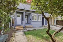

Similar Duplexes for Sale in Vancouver
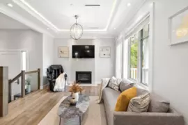 5.4% price reduction
$1,768,000
3666 W 6th Avenue, Vancouver, BC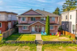 6.8% price reduction
$2,050,000
423-425 E 2nd Street, North Vancouver, BC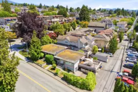
$2,299,000
338-342 St. Georges Avenue, North Vancouver, BC 9.1% price reduction
$1,499,000
2 6118 Irmin Street, Burnaby, BC 9.1% price reduction
$1,499,000
3 6118 Irmin Street, Burnaby, BC
$1,489,000
103 1518 Hatton Avenue, Burnaby, BC
$2,199,999
7251 7271 Lombard Road, Richmond, BC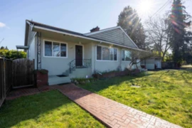 12.0% price reduction
$1,980,000
7720 7722 Graham Avenue, Burnaby, BC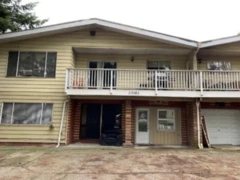
$2,400,000
23180 23182 Westminster Highway, Richmond, BC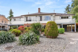
$1,999,900
10151 Rosedene Crescent, Richmond, BC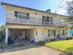
$1,968,000
804-806 Ingersoll Avenue, Coquitlam, BC
$1,890,000
1046 Madore Avenue, Coquitlam, BC