By car (off-peak)


Sold
1436 Pitt River Road, Port Coquitlam, BC
4
Beds
3
Baths
1832
sqft
1981
built


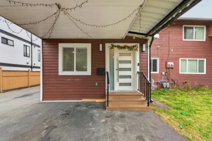
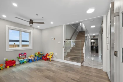
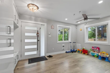
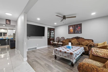
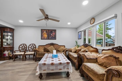
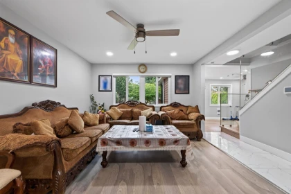
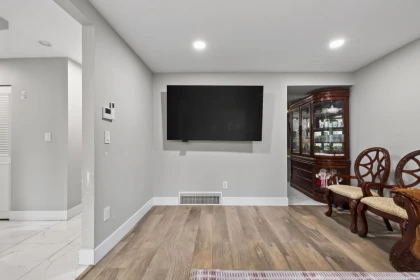
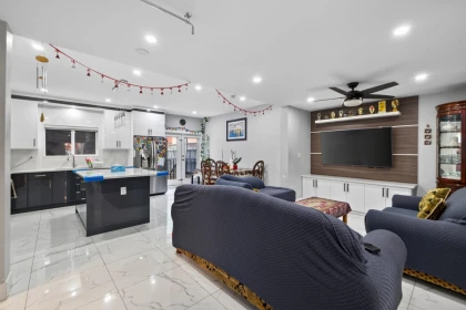
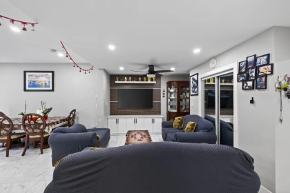
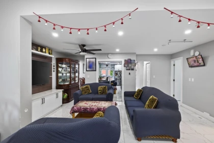
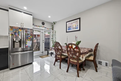
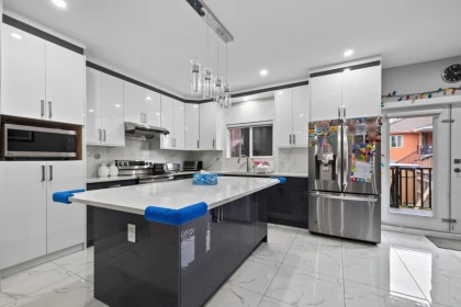
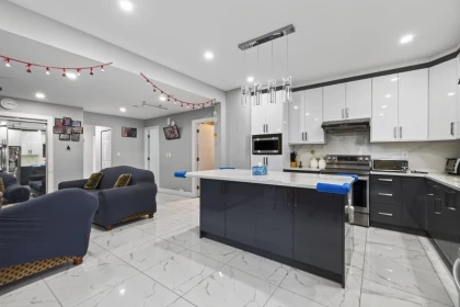
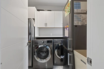
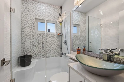
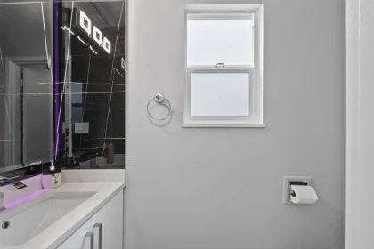
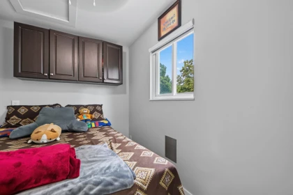
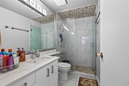
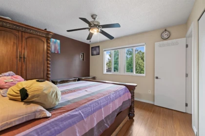
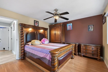
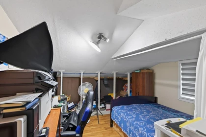
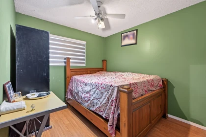
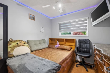
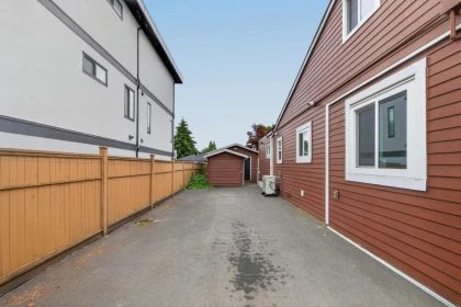
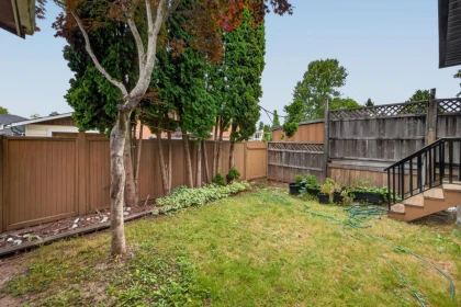
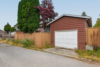
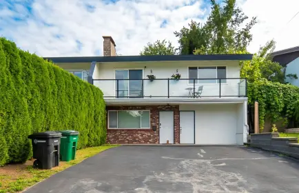
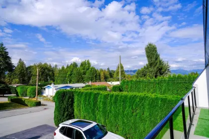
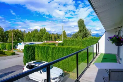
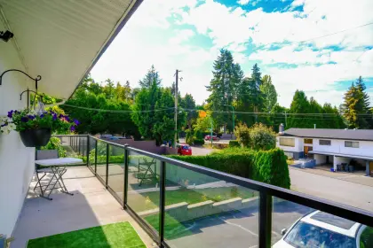
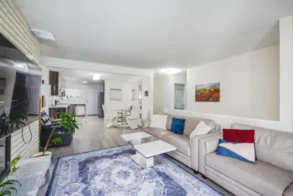
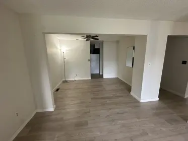
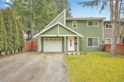
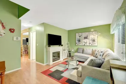
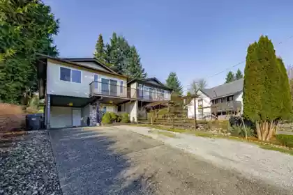
Fully renovated 4-bed, 3-bath half-duplex on a generous ~5,000 sq. ft. lot a desirable location. Features modern finishes throughout, bright open living spaces, and a practical layout ideal for families. Enjoy abundant parking plus convenient lane access. Move-in ready with a private yard and excellent location close to amenities. A rare opportunity for space and updates in one package.
| Price | $1,049,000 |
|---|---|
| Total Bedrooms | 4 |
| Total Bathrooms | 3 |
| Full Bathrooms | 2 |
| Half Bathrooms | 1 |
| Floor Area Total (sqft) | 2095 |
| Year Built | 1978 |
| Age Of Building | 48 |
| Building Type | Half Duplex |
| Property Type | Residential |
| Architecture Style | Basement Entry |
| Stories | 2 |
| Ownership Type | Freehold Strata |
| Maintenance Fee | 0 |
| Utility Type | Electricity Connected, Natural Gas Connected, Water Connected |
| Utility Sewer | Community, Sanitary Sewer |
| Water (WaterSource) | Public |
| Parking Type | Carport Single, Garage Single, RV Access/Parking, Front Access, Rear Access |
| Total Parking Spaces | 8 |
| Strata Restrictions | No Restrictions |
| Rental Suites | None |
| Basement Finished Area (sqft) | 0 |
|---|---|
| Basement Features | Exterior Entry, Crawl Space, None |
| Appliances Included | Washer/Dryer, Dishwasher, Refrigerator, Stove |
| Heating Type | Forced Air, Natural Gas |
| Cooling | Central Air, Air Conditioning |
| # of Kitchens | 1 |
| Flooring | Mixed, Tile, Vinyl |
| Foundation | Concrete Perimeter |
| Roof | Asphalt |
|---|---|
| Structures | Duplex, Residential Attached |
| Lot Size | 5000 |
|---|---|
| MLS® # | R3150125 |
| Area | Surrey |
| Neighbourhood | Queen Mary Park Surrey |
| City | Surrey |
| Postal Code | V3V 6W3 |
| Gross Taxes | $4,342.67 |
| Zoning | R2 |
| Floor | Type | Dimensions |
|---|---|---|
| Above Level | Primary Bedroom | 12'2 x 12'2 ft |
| Above Level | Bedroom | 11'10 x 11'10 ft |
| Above Level | Bedroom | 10'10 x 10'10 ft |
| Above Level | Loft | 10'11 x 10'11 ft |
| Main Level | Living Room | 18'5 x 18'5 ft |
| Main Level | Dining Room | 6'6 x 6'6 ft |
| Main Level | Kitchen | 13'1 x 13'1 ft |
| Main Level | Family Room | 18'8 x 18'8 ft |
| Main Level | Foyer | 15'0 x 15'0 ft |
| Main Level | Laundry | 6'9 x 6'9 ft |
| Main Level | Bedroom | 6'9 x 6'9 ft |
| Floor | Ensuite | Pieces |
|---|---|---|
| Above Level | No | #4 |
| Main Level | No | #4 |
| Above Level | No | #2 |
Listed by: Sutton Group-West Coast Realty (Abbotsford)
NOTE: This representation is based in whole or in part on data generated by the Chilliwack & District Real Estate Board, Fraser Valley Real Estate Board or Greater Vancouver REALTORS® which assumes no responsibility for its accuracy.
SkyTrain 1.24 km · Queen Elizabeth Secondary School 5.4/10 · 0.63 km · crime average · flood lower risk · wildfire low


Public Schools
Information includes BC Government Open License data; school details change often and are offered solely as general guidance.
Private Schools
Closest Transit
Crime Rate
Demographics
Noise/ Power Lines
Other
Natural hazards vary by location and can change over time. The following provides a summary of potential impacts to this area, postal code V3V 6W3, over the next 30 years. Projections use the 2041–2070 period (2050s) under a moderate emissions scenario (SSP2-4.5).
Outside of designated flood hazard zones. Under 10% of buildings in this area have flood risk over the next 30 years.
Located within the "Vancouver" WUI zone (Risk Class 5 — Low). Based on BC Wildfire Service provincial WUI Risk Class mapping; not a site-specific assessment.
Annual avg PM2.5 4.5 µg/m³ — meets WHO 2021 guideline. Nearest station: North Delta, Delta (~3.8 km). Annual avg AQHI 2.1 — Low Risk.
Surrey currently sees ~1 day above 30 °C per year (1981–2010 baseline), projected to rise to ~8 by the 2050s (SSP2-4.5 moderate emissions). Hottest day of the year: ~30 °C baseline, ~32.5 °C projected. Tropical nights (>18 °C): ~0 baseline, ~3 projected.
Annual precipitation ~1516 mm (1981–2010 baseline), projected ~1574 mm by the 2050s. Extreme 1-day rainfall: ~51.5 mm baseline, ~57.1 mm projected. Values vary modestly across the Lower Mainland.
Longest annual dry spell (consecutive dry days): ~23 days baseline, ~24 days projected for the 2050s. CDD is used as a regional drought proxy; drought risk varies modestly across the Lower Mainland.
29 Schools are within 3km
| School | Type | Grades Served | Catchment Info | Rating | Distance |
|---|---|---|---|---|---|
Betty Huff Elementary School |
Public |
Grades ServedK-7
|
Catchment Info—
|
Distance365 m
|
|
Continuing Ed SD36 (Queen Elizabeth) |
Public |
Grades Served—
|
Catchment Info—
|
Distance625 m
|
|
Queen Elizabeth Secondary School |
Public |
Grades Served8-12
|
Catchment InfoIn Catchment
|
Distance626 m
|
|
Cindrich Elementary School |
Public |
Grades ServedK-7
|
Catchment InfoIn Catchment
|
Distance895 m
|
|
David Brankin Elementary School |
Public |
Grades ServedK-7
|
Catchment Info—
|
Distance985 m
|
|
Senator Reid Elementary School |
Public |
Grades ServedK-7
|
Catchment Info—
|
Distance1.37 KM
|
|
Old Yale Road Elementary School |
Public |
Grades ServedK-7
|
Catchment Info—
|
Distance1.41 KM
|
|
Creekside Elementary School |
Public |
Grades ServedK-7
|
Catchment Info—
|
Distance1.45 KM
|
|
North Surrey Learning Centre |
Public |
Grades Served10-12
|
Catchment Info—
|
Distance1.60 KM
|
|
Simon Cunningham Elementary School |
Public |
Grades ServedK-7
|
Catchment Info—
|
Distance1.62 KM
|
|
Continuing Ed SD36 (Invergarry) |
Public |
Grades Served—
|
Catchment Info—
|
Distance1.65 KM
|
|
Education Services (Alternate) |
Public |
Grades Served—
|
Catchment Info—
|
Distance1.74 KM
|
|
SD 36 Alternate North Surrey LC |
Public |
Grades Served—
|
Catchment Info—
|
Distance1.77 KM
|
|
Cedar Hills Elementary School |
Public |
Grades ServedK-7
|
Catchment Info—
|
Distance1.87 KM
|
|
Prince Charles Elementary School |
Public |
Grades ServedK-7
|
Catchment Info—
|
Distance1.96 KM
|
|
Sikh Academy |
Independent |
Grades ServedK-7
|
Catchment Info—
|
Distance1.96 KM
|
|
L A Matheson Secondary School |
Public |
Grades Served8-12
|
Catchment Info—
|
Distance2.03 KM
|
|
Kwantlen Park Secondary School |
Public |
Grades Served8-12
|
Catchment Info—
|
Distance2.04 KM
|
|
Kirkbride Elementary School |
Public |
Grades ServedK-7
|
Catchment Info—
|
Distance2.21 KM
|
|
K B Woodward Elementary School |
Public |
Grades ServedK-7
|
Catchment Info—
|
Distance2.34 KM
|
|
Lena Shaw Elementary School |
Public |
Grades ServedK-7
|
Catchment Info—
|
Distance2.39 KM
|
|
Our Lady of Good Counsel |
Independent |
Grades ServedK-7
|
Catchment Info—
|
Distance2.51 KM
|
|
Green Timbers Elementary School |
Public |
Grades ServedK-7
|
Catchment Info—
|
Distance2.65 KM
|
|
Newton Elementary School |
Public |
Grades ServedK-7
|
Catchment Info—
|
Distance2.66 KM
|
|
Brookside Elementary School |
Public |
Grades ServedK-7
|
Catchment Info—
|
Distance2.67 KM
|
|
Immaculate Conception School |
Independent |
Grades ServedK-7
|
Catchment Info—
|
Distance2.88 KM
|
|
Immaculate Conception |
Independent |
Grades Served—
|
Catchment Info—
|
Distance2.92 KM
|
|
City Central Learning Centre |
Public |
Grades Served10-12
|
Catchment Info—
|
Distance2.92 KM
|
|
Forsyth Road Elementary School |
Public |
Grades ServedK-7
|
Catchment Info—
|
Distance2.92 KM
|
Calculate your commute
9441 132a St, Surrey, BC is ideally located for commuters. The property is 1.2 km from King George, with a 58 min SkyTrain ride to Downtown Vancouver (Waterfront Station). The closest bus stop is Northbound 132 St @ Huntley Ave (0.16 km). Walk Score Transit rating: Good Transit (68/100).


| Year | Land | Improvements | Total Assessed | YOY Change |
|---|---|---|---|---|
| 2026 | $904,000 | $102,000 | $1,006,000 | — |
Monthly cost about $4,589/month · rent estimate $3,241/month · owning catches up with renting by year 9 · cash flow if rented −$1,555/month
The estimated monthly cost of 9441 132a Street, Surrey is $4,589: $4,227 principal and interest with 20% down over 30 years at 4.45%, plus $362 property tax.
If 9441 132a Street, Surrey were rented at $3,241 a month with 5% vacancy, it would fall $1,555 a month short of the mortgage and carrying costs; about 50% down would break even.
Example shown is the principal portion at year 5 of the mortgage. It grows over the loan: ~$1,138/mo (year 1) → ~$2,647/mo (year 20) → ~$3,948/mo (year 29).
EstateBlock estimates 9441 132a Street, Surrey would rent for about $3,241 a month.
Rent vs own
Owning catches up by year 9
With 20% down ($209,800) at 4.45%: renting is cheaper at first, but principal paydown closes the gap
Assumes 20% down payment, 4.45% fixed rate, 30-year amortization. Rent line = full rent (money gone). Own line = interest + property tax + fees, excluding principal (money you keep as equity). No appreciation, investment returns or transaction costs included.
Renting 9441 132a Street, Surrey is cheaper at first, but owning catches up by year 9, with $74,784 of principal paid off by year 5 and $168,165 by year 10.
No active comparable properties are currently available for this property type in Surrey. The price evaluation chart will update as similar listings enter the market.

Potential Cashback for this listing if you buy with us
to track your cashback progress
Buy with us & save on this property
$969,000
9443 132a Street, Surrey, BC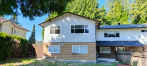
$1,050,000
9687 131 Street, Surrey, BC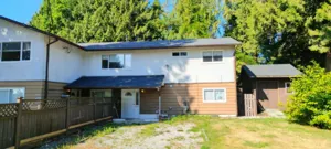
$1,050,000
9689 131 Street, Surrey, BC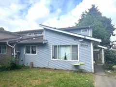
$869,000
9077 135a Street, Surrey, BC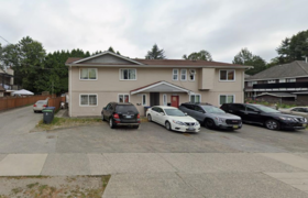
$1,250,000
13067 88 Avenue, Surrey, BC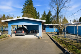
$1,150,000
12337 98 Avenue, Surrey, BC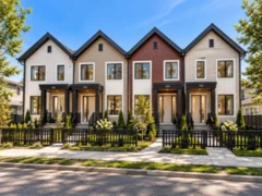
$1,099,000
102 10151 144 Street, Surrey, BC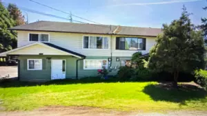
$1,150,000
14424 104a Avenue, Surrey, BC
$1,128,888
15159 93 Avenue, Surrey, BC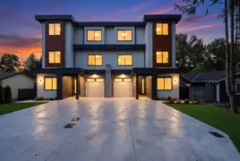 11.1% price reduction
$1,198,000
102 13437 Crestview Drive, Surrey, BC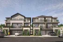
$1,249,000
101 12848 114b Avenue, Surrey, BC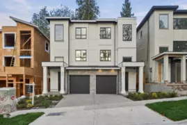
$1,149,999
102 11448 138a Street, Surrey, BC